You are here: Home > Network List > TA - USArray Transportable Network (new EarthScope stations) Stations List
> Station S26A Kim, CO, USA > Earthquake Result Viewer
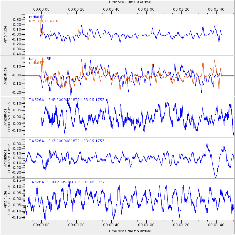
S26A Kim, CO, USA - Earthquake Result Viewer
*The percent match for this event was below the threshold and hence no stack was calculated.
| Earthquake location: |
South Of Fiji Islands |
| Earthquake latitude/longitude: |
-26.1/-178.4 |
| Earthquake time(UTC): |
2009/08/18 (230) 21:20:47 GMT |
| Earthquake Depth: |
270 km |
| Earthquake Magnitude: |
5.5 MB, 6.3 MW, 6.3 MW |
| Earthquake Catalog/Contributor: |
WHDF/NEIC |
|
| Network: |
TA USArray Transportable Network (new EarthScope stations) |
| Station: |
S26A Kim, CO, USA |
| Lat/Lon: |
37.62 N/103.47 W |
| Elevation: |
1394 m |
|
| Distance: |
94.6 deg |
| Az: |
50.277 deg |
| Baz: |
240.606 deg |
| Ray Param: |
$rayparam |
*The percent match for this event was below the threshold and hence was not used in the summary stack. |
|
| Radial Match: |
63.188313 % |
| Radial Bump: |
400 |
| Transverse Match: |
47.72796 % |
| Transverse Bump: |
400 |
| SOD ConfigId: |
2622 |
| Insert Time: |
2010-03-06 20:03:41.335 +0000 |
| GWidth: |
2.5 |
| Max Bumps: |
400 |
| Tol: |
0.001 |
|
Signal To Noise
| Channel | StoN | STA | LTA |
| TA:S26A: :BHZ:20090818T21:33:06.175Z | 2.242221 | 1.2826595E-7 | 5.720486E-8 |
| TA:S26A: :BHN:20090818T21:33:06.175Z | 1.5539378 | 8.191431E-8 | 5.271402E-8 |
| TA:S26A: :BHE:20090818T21:33:06.175Z | 0.58883494 | 3.21337E-8 | 5.4571654E-8 |
| Arrivals |
| Ps | |
| PpPs | |
| PsPs/PpSs | |


