You are here: Home > Network List > TA - USArray Transportable Network (new EarthScope stations) Stations List
> Station S26A Kim, CO, USA > Earthquake Result Viewer
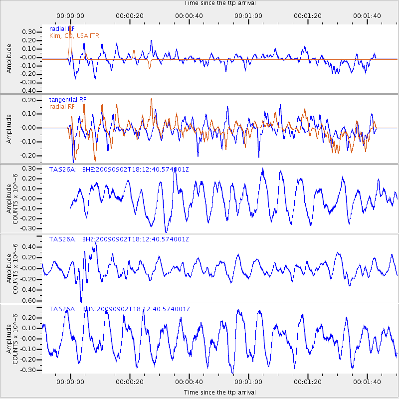
S26A Kim, CO, USA - Earthquake Result Viewer
*The percent match for this event was below the threshold and hence no stack was calculated.
| Earthquake location: |
Kermadec Islands, New Zealand |
| Earthquake latitude/longitude: |
-29.4/-179.0 |
| Earthquake time(UTC): |
2009/09/02 (245) 18:00:11 GMT |
| Earthquake Depth: |
275 km |
| Earthquake Magnitude: |
5.8 MB, 6.2 MW, 6.1 MW |
| Earthquake Catalog/Contributor: |
WHDF/NEIC |
|
| Network: |
TA USArray Transportable Network (new EarthScope stations) |
| Station: |
S26A Kim, CO, USA |
| Lat/Lon: |
37.62 N/103.47 W |
| Elevation: |
1394 m |
|
| Distance: |
97.1 deg |
| Az: |
50.764 deg |
| Baz: |
238.384 deg |
| Ray Param: |
$rayparam |
*The percent match for this event was below the threshold and hence was not used in the summary stack. |
|
| Radial Match: |
50.926113 % |
| Radial Bump: |
400 |
| Transverse Match: |
31.797373 % |
| Transverse Bump: |
291 |
| SOD ConfigId: |
2622 |
| Insert Time: |
2010-03-06 20:03:42.199 +0000 |
| GWidth: |
2.5 |
| Max Bumps: |
400 |
| Tol: |
0.001 |
|
Signal To Noise
| Channel | StoN | STA | LTA |
| TA:S26A: :BHZ:20090902T18:12:40.574001Z | 2.8107753 | 2.4219378E-7 | 8.616618E-8 |
| TA:S26A: :BHN:20090902T18:12:40.574001Z | 0.94120365 | 1.4419305E-7 | 1.5320069E-7 |
| TA:S26A: :BHE:20090902T18:12:40.574001Z | 2.4848204 | 2.033683E-7 | 8.184426E-8 |
| Arrivals |
| Ps | |
| PpPs | |
| PsPs/PpSs | |


