You are here: Home > Network List > TA - USArray Transportable Network (new EarthScope stations) Stations List
> Station S26A Kim, CO, USA > Earthquake Result Viewer
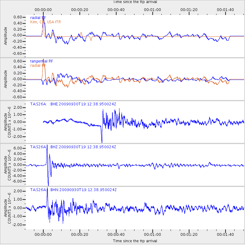
S26A Kim, CO, USA - Earthquake Result Viewer
*The percent match for this event was below the threshold and hence no stack was calculated.
| Earthquake location: |
Peru-Bolivia Border Region |
| Earthquake latitude/longitude: |
-15.6/-69.3 |
| Earthquake time(UTC): |
2009/09/30 (273) 19:03:17 GMT |
| Earthquake Depth: |
255 km |
| Earthquake Magnitude: |
5.9 MB, 5.8 MW |
| Earthquake Catalog/Contributor: |
WHDF/NEIC |
|
| Network: |
TA USArray Transportable Network (new EarthScope stations) |
| Station: |
S26A Kim, CO, USA |
| Lat/Lon: |
37.62 N/103.47 W |
| Elevation: |
1394 m |
|
| Distance: |
61.9 deg |
| Az: |
329.62 deg |
| Baz: |
142.129 deg |
| Ray Param: |
$rayparam |
*The percent match for this event was below the threshold and hence was not used in the summary stack. |
|
| Radial Match: |
59.064453 % |
| Radial Bump: |
400 |
| Transverse Match: |
65.270485 % |
| Transverse Bump: |
400 |
| SOD ConfigId: |
2622 |
| Insert Time: |
2010-03-06 20:03:48.618 +0000 |
| GWidth: |
2.5 |
| Max Bumps: |
400 |
| Tol: |
0.001 |
|
Signal To Noise
| Channel | StoN | STA | LTA |
| TA:S26A: :BHZ:20090930T19:12:38.950024Z | 26.222328 | 3.0076217E-6 | 1.1469697E-7 |
| TA:S26A: :BHN:20090930T19:12:38.950024Z | 4.8502526 | 7.998003E-7 | 1.648987E-7 |
| TA:S26A: :BHE:20090930T19:12:38.950024Z | 5.512323 | 9.767077E-7 | 1.7718625E-7 |
| Arrivals |
| Ps | |
| PpPs | |
| PsPs/PpSs | |


