You are here: Home > Network List > TA - USArray Transportable Network (new EarthScope stations) Stations List
> Station S26A Kim, CO, USA > Earthquake Result Viewer
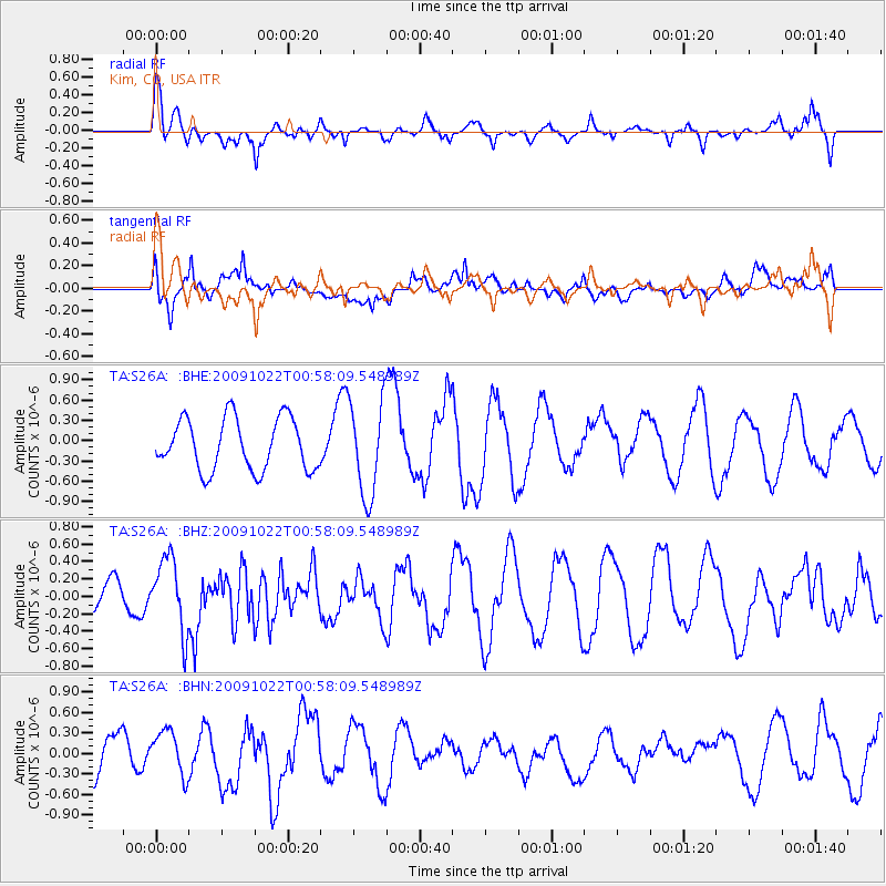
S26A Kim, CO, USA - Earthquake Result Viewer
*The percent match for this event was below the threshold and hence no stack was calculated.
| Earthquake location: |
South Of Panama |
| Earthquake latitude/longitude: |
6.7/-82.6 |
| Earthquake time(UTC): |
2009/10/22 (295) 00:51:39 GMT |
| Earthquake Depth: |
18 km |
| Earthquake Magnitude: |
5.5 MB, 5.4 MS, 5.9 MW, 5.9 MW |
| Earthquake Catalog/Contributor: |
WHDF/NEIC |
|
| Network: |
TA USArray Transportable Network (new EarthScope stations) |
| Station: |
S26A Kim, CO, USA |
| Lat/Lon: |
37.62 N/103.47 W |
| Elevation: |
1394 m |
|
| Distance: |
36.1 deg |
| Az: |
331.309 deg |
| Baz: |
143.094 deg |
| Ray Param: |
$rayparam |
*The percent match for this event was below the threshold and hence was not used in the summary stack. |
|
| Radial Match: |
76.3722 % |
| Radial Bump: |
400 |
| Transverse Match: |
51.576538 % |
| Transverse Bump: |
400 |
| SOD ConfigId: |
2622 |
| Insert Time: |
2010-03-06 20:03:56.640 +0000 |
| GWidth: |
2.5 |
| Max Bumps: |
400 |
| Tol: |
0.001 |
|
Signal To Noise
| Channel | StoN | STA | LTA |
| TA:S26A: :BHZ:20091022T00:58:09.548989Z | 1.4285814 | 4.246366E-7 | 2.9724356E-7 |
| TA:S26A: :BHN:20091022T00:58:09.548989Z | 0.9500637 | 3.2253394E-7 | 3.3948663E-7 |
| TA:S26A: :BHE:20091022T00:58:09.548989Z | 1.8385009 | 7.015758E-7 | 3.8160212E-7 |
| Arrivals |
| Ps | |
| PpPs | |
| PsPs/PpSs | |


