You are here: Home > Network List > TA - USArray Transportable Network (new EarthScope stations) Stations List
> Station S26A Kim, CO, USA > Earthquake Result Viewer
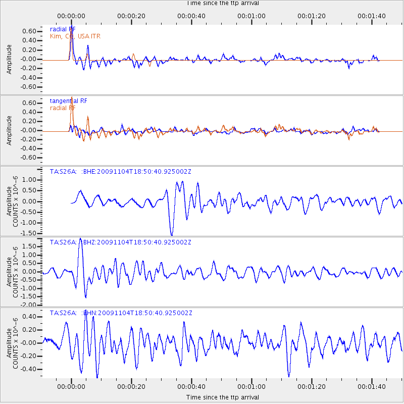
S26A Kim, CO, USA - Earthquake Result Viewer
*The percent match for this event was below the threshold and hence no stack was calculated.
| Earthquake location: |
Azores Islands Region |
| Earthquake latitude/longitude: |
36.2/-33.9 |
| Earthquake time(UTC): |
2009/11/04 (308) 18:41:44 GMT |
| Earthquake Depth: |
10 km |
| Earthquake Magnitude: |
5.7 MB, 5.6 MS, 5.9 MW, 5.8 MW |
| Earthquake Catalog/Contributor: |
WHDF/NEIC |
|
| Network: |
TA USArray Transportable Network (new EarthScope stations) |
| Station: |
S26A Kim, CO, USA |
| Lat/Lon: |
37.62 N/103.47 W |
| Elevation: |
1394 m |
|
| Distance: |
54.5 deg |
| Az: |
293.872 deg |
| Baz: |
68.756 deg |
| Ray Param: |
$rayparam |
*The percent match for this event was below the threshold and hence was not used in the summary stack. |
|
| Radial Match: |
79.660576 % |
| Radial Bump: |
365 |
| Transverse Match: |
64.00587 % |
| Transverse Bump: |
400 |
| SOD ConfigId: |
2622 |
| Insert Time: |
2010-03-06 20:04:00.785 +0000 |
| GWidth: |
2.5 |
| Max Bumps: |
400 |
| Tol: |
0.001 |
|
Signal To Noise
| Channel | StoN | STA | LTA |
| TA:S26A: :BHZ:20091104T18:50:40.925002Z | 9.646346 | 1.0261099E-6 | 1.0637291E-7 |
| TA:S26A: :BHN:20091104T18:50:40.925002Z | 3.095257 | 2.5219373E-7 | 8.1477474E-8 |
| TA:S26A: :BHE:20091104T18:50:40.925002Z | 4.0105577 | 7.2598255E-7 | 1.8101785E-7 |
| Arrivals |
| Ps | |
| PpPs | |
| PsPs/PpSs | |


