You are here: Home > Network List > TA - USArray Transportable Network (new EarthScope stations) Stations List
> Station S26A Kim, CO, USA > Earthquake Result Viewer
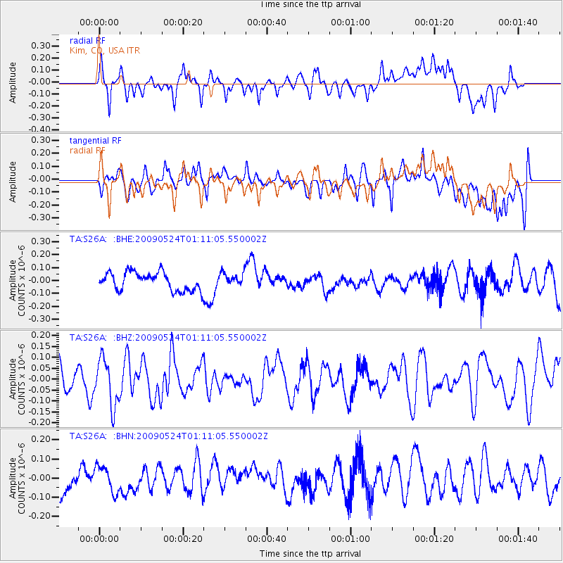
S26A Kim, CO, USA - Earthquake Result Viewer
*The percent match for this event was below the threshold and hence no stack was calculated.
| Earthquake location: |
Kermadec Islands Region |
| Earthquake latitude/longitude: |
-31.5/-177.7 |
| Earthquake time(UTC): |
2009/05/24 (144) 00:58:02 GMT |
| Earthquake Depth: |
4.0 km |
| Earthquake Magnitude: |
5.6 MB, 5.9 MS, 6.0 MW, 5.8 MW |
| Earthquake Catalog/Contributor: |
WHDF/NEIC |
|
| Network: |
TA USArray Transportable Network (new EarthScope stations) |
| Station: |
S26A Kim, CO, USA |
| Lat/Lon: |
37.62 N/103.47 W |
| Elevation: |
1394 m |
|
| Distance: |
97.5 deg |
| Az: |
50.421 deg |
| Baz: |
236.033 deg |
| Ray Param: |
$rayparam |
*The percent match for this event was below the threshold and hence was not used in the summary stack. |
|
| Radial Match: |
62.63486 % |
| Radial Bump: |
400 |
| Transverse Match: |
41.013542 % |
| Transverse Bump: |
400 |
| SOD ConfigId: |
2648 |
| Insert Time: |
2010-03-06 20:04:03.824 +0000 |
| GWidth: |
2.5 |
| Max Bumps: |
400 |
| Tol: |
0.001 |
|
Signal To Noise
| Channel | StoN | STA | LTA |
| TA:S26A: :BHZ:20090524T01:11:05.550002Z | 2.1536176 | 1.1010225E-7 | 5.1124324E-8 |
| TA:S26A: :BHN:20090524T01:11:05.550002Z | 0.9607324 | 6.934902E-8 | 7.21835E-8 |
| TA:S26A: :BHE:20090524T01:11:05.550002Z | 0.77537215 | 5.4080928E-8 | 6.9748346E-8 |
| Arrivals |
| Ps | |
| PpPs | |
| PsPs/PpSs | |


