You are here: Home > Network List > TA - USArray Transportable Network (new EarthScope stations) Stations List
> Station S26A Kim, CO, USA > Earthquake Result Viewer
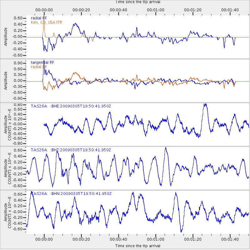
S26A Kim, CO, USA - Earthquake Result Viewer
*The percent match for this event was below the threshold and hence no stack was calculated.
| Earthquake location: |
North Of Svalbard |
| Earthquake latitude/longitude: |
80.3/-1.8 |
| Earthquake time(UTC): |
2009/03/05 (064) 19:41:40 GMT |
| Earthquake Depth: |
10 km |
| Earthquake Magnitude: |
5.5 MB, 5.0 MS, 5.4 MW |
| Earthquake Catalog/Contributor: |
WHDF/NEIC |
|
| Network: |
TA USArray Transportable Network (new EarthScope stations) |
| Station: |
S26A Kim, CO, USA |
| Lat/Lon: |
37.62 N/103.47 W |
| Elevation: |
1394 m |
|
| Distance: |
55.1 deg |
| Az: |
288.56 deg |
| Baz: |
11.701 deg |
| Ray Param: |
$rayparam |
*The percent match for this event was below the threshold and hence was not used in the summary stack. |
|
| Radial Match: |
57.187923 % |
| Radial Bump: |
400 |
| Transverse Match: |
64.76506 % |
| Transverse Bump: |
400 |
| SOD ConfigId: |
2658 |
| Insert Time: |
2010-03-06 20:04:04.676 +0000 |
| GWidth: |
2.5 |
| Max Bumps: |
400 |
| Tol: |
0.001 |
|
Signal To Noise
| Channel | StoN | STA | LTA |
| TA:S26A: :BHZ:20090305T19:50:41.950Z | 1.9384925 | 3.4353187E-7 | 1.7721598E-7 |
| TA:S26A: :BHN:20090305T19:50:41.950Z | 0.76884747 | 2.2550485E-7 | 2.9330243E-7 |
| TA:S26A: :BHE:20090305T19:50:41.950Z | 1.2128996 | 2.1671659E-7 | 1.7867644E-7 |
| Arrivals |
| Ps | |
| PpPs | |
| PsPs/PpSs | |


