You are here: Home > Network List > TA - USArray Transportable Network (new EarthScope stations) Stations List
> Station S26A Kim, CO, USA > Earthquake Result Viewer
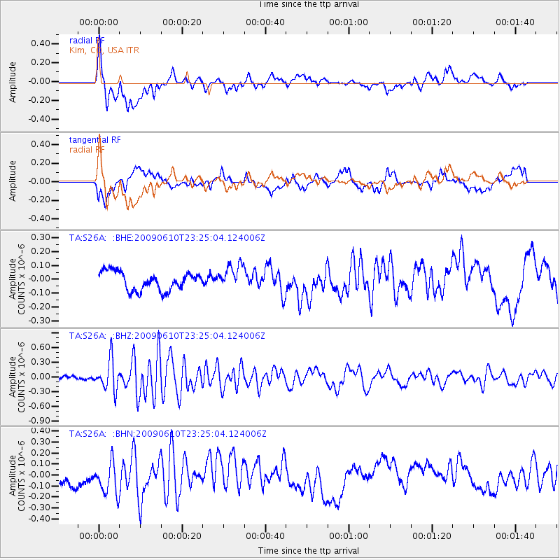
S26A Kim, CO, USA - Earthquake Result Viewer
*The percent match for this event was below the threshold and hence no stack was calculated.
| Earthquake location: |
West Chile Rise |
| Earthquake latitude/longitude: |
-41.7/-84.0 |
| Earthquake time(UTC): |
2009/06/10 (161) 23:13:21 GMT |
| Earthquake Depth: |
10 km |
| Earthquake Magnitude: |
5.7 MB, 5.2 MS, 5.7 MW, 5.6 MW |
| Earthquake Catalog/Contributor: |
WHDF/NEIC |
|
| Network: |
TA USArray Transportable Network (new EarthScope stations) |
| Station: |
S26A Kim, CO, USA |
| Lat/Lon: |
37.62 N/103.47 W |
| Elevation: |
1394 m |
|
| Distance: |
80.9 deg |
| Az: |
344.45 deg |
| Baz: |
165.359 deg |
| Ray Param: |
$rayparam |
*The percent match for this event was below the threshold and hence was not used in the summary stack. |
|
| Radial Match: |
61.754887 % |
| Radial Bump: |
400 |
| Transverse Match: |
58.339245 % |
| Transverse Bump: |
400 |
| SOD ConfigId: |
2648 |
| Insert Time: |
2010-03-06 20:04:09.991 +0000 |
| GWidth: |
2.5 |
| Max Bumps: |
400 |
| Tol: |
0.001 |
|
Signal To Noise
| Channel | StoN | STA | LTA |
| TA:S26A: :BHZ:20090610T23:25:04.124006Z | 8.05583 | 3.2024255E-7 | 3.9752894E-8 |
| TA:S26A: :BHN:20090610T23:25:04.124006Z | 1.8908496 | 1.5008003E-7 | 7.9371745E-8 |
| TA:S26A: :BHE:20090610T23:25:04.124006Z | 1.4098994 | 9.246724E-8 | 6.558429E-8 |
| Arrivals |
| Ps | |
| PpPs | |
| PsPs/PpSs | |


