You are here: Home > Network List > TA - USArray Transportable Network (new EarthScope stations) Stations List
> Station S26A Kim, CO, USA > Earthquake Result Viewer
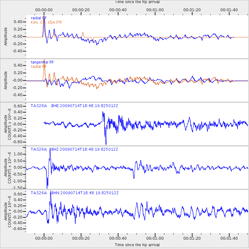
S26A Kim, CO, USA - Earthquake Result Viewer
*The percent match for this event was below the threshold and hence no stack was calculated.
| Earthquake location: |
Chile-Bolivia Border Region |
| Earthquake latitude/longitude: |
-21.8/-67.1 |
| Earthquake time(UTC): |
2009/07/14 (195) 18:38:08 GMT |
| Earthquake Depth: |
176 km |
| Earthquake Magnitude: |
5.7 MW, 5.4 MB, 5.7 MW |
| Earthquake Catalog/Contributor: |
WHDF/NEIC |
|
| Network: |
TA USArray Transportable Network (new EarthScope stations) |
| Station: |
S26A Kim, CO, USA |
| Lat/Lon: |
37.62 N/103.47 W |
| Elevation: |
1394 m |
|
| Distance: |
68.3 deg |
| Az: |
329.545 deg |
| Baz: |
143.62 deg |
| Ray Param: |
$rayparam |
*The percent match for this event was below the threshold and hence was not used in the summary stack. |
|
| Radial Match: |
79.89964 % |
| Radial Bump: |
400 |
| Transverse Match: |
72.652534 % |
| Transverse Bump: |
400 |
| SOD ConfigId: |
2648 |
| Insert Time: |
2010-03-06 20:04:15.374 +0000 |
| GWidth: |
2.5 |
| Max Bumps: |
400 |
| Tol: |
0.001 |
|
Signal To Noise
| Channel | StoN | STA | LTA |
| TA:S26A: :BHZ:20090714T18:48:19.825012Z | 12.559632 | 6.3141164E-7 | 5.02731E-8 |
| TA:S26A: :BHN:20090714T18:48:19.825012Z | 4.4923544 | 2.517394E-7 | 5.6037297E-8 |
| TA:S26A: :BHE:20090714T18:48:19.825012Z | 5.0151367 | 2.421966E-7 | 4.8293117E-8 |
| Arrivals |
| Ps | |
| PpPs | |
| PsPs/PpSs | |


