You are here: Home > Network List > CI - Caltech Regional Seismic Network Stations List
> Station MPM Manuel Prospect Mine, California, USA > Earthquake Result Viewer
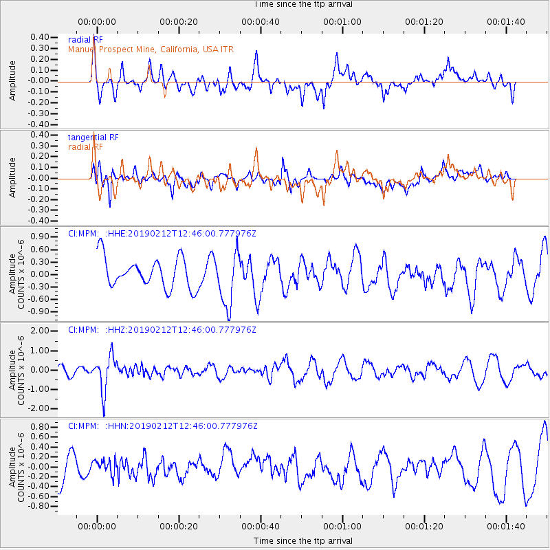
MPM Manuel Prospect Mine, California, USA - Earthquake Result Viewer
*The percent match for this event was below the threshold and hence no stack was calculated.
| Earthquake location: |
Mariana Islands |
| Earthquake latitude/longitude: |
19.1/145.8 |
| Earthquake time(UTC): |
2019/02/12 (043) 12:34:15 GMT |
| Earthquake Depth: |
130 km |
| Earthquake Magnitude: |
5.9 mww |
| Earthquake Catalog/Contributor: |
NEIC PDE/us |
|
| Network: |
CI Caltech Regional Seismic Network |
| Station: |
MPM Manuel Prospect Mine, California, USA |
| Lat/Lon: |
36.06 N/117.49 W |
| Elevation: |
185 m |
|
| Distance: |
84.2 deg |
| Az: |
53.977 deg |
| Baz: |
289.263 deg |
| Ray Param: |
$rayparam |
*The percent match for this event was below the threshold and hence was not used in the summary stack. |
|
| Radial Match: |
39.70467 % |
| Radial Bump: |
400 |
| Transverse Match: |
61.074986 % |
| Transverse Bump: |
400 |
| SOD ConfigId: |
13570011 |
| Insert Time: |
2019-05-02 12:43:54.384 +0000 |
| GWidth: |
2.5 |
| Max Bumps: |
400 |
| Tol: |
0.001 |
|
Signal To Noise
| Channel | StoN | STA | LTA |
| CI:MPM: :HHZ:20190212T12:46:00.777976Z | 4.103721 | 9.242654E-7 | 2.2522619E-7 |
| CI:MPM: :HHN:20190212T12:46:00.777976Z | 0.59556377 | 1.7308304E-7 | 2.906205E-7 |
| CI:MPM: :HHE:20190212T12:46:00.777976Z | 1.8682688 | 6.492094E-7 | 3.474925E-7 |
| Arrivals |
| Ps | |
| PpPs | |
| PsPs/PpSs | |


