You are here: Home > Network List > CN - Canadian National Seismograph Network Stations List
> Station INK INUVIK, NT > Earthquake Result Viewer
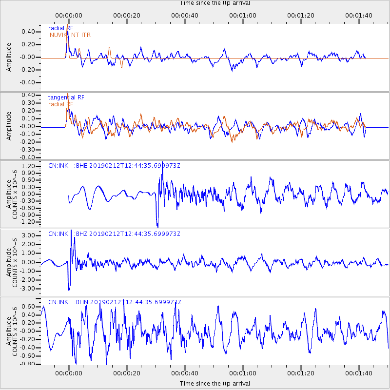
INK INUVIK, NT - Earthquake Result Viewer
*The percent match for this event was below the threshold and hence no stack was calculated.
| Earthquake location: |
Mariana Islands |
| Earthquake latitude/longitude: |
19.1/145.8 |
| Earthquake time(UTC): |
2019/02/12 (043) 12:34:15 GMT |
| Earthquake Depth: |
130 km |
| Earthquake Magnitude: |
5.9 mww |
| Earthquake Catalog/Contributor: |
NEIC PDE/us |
|
| Network: |
CN Canadian National Seismograph Network |
| Station: |
INK INUVIK, NT |
| Lat/Lon: |
68.31 N/133.53 W |
| Elevation: |
44 m |
|
| Distance: |
69.0 deg |
| Az: |
23.142 deg |
| Baz: |
268.707 deg |
| Ray Param: |
$rayparam |
*The percent match for this event was below the threshold and hence was not used in the summary stack. |
|
| Radial Match: |
72.192825 % |
| Radial Bump: |
400 |
| Transverse Match: |
59.98632 % |
| Transverse Bump: |
400 |
| SOD ConfigId: |
13570011 |
| Insert Time: |
2019-05-02 12:44:36.187 +0000 |
| GWidth: |
2.5 |
| Max Bumps: |
400 |
| Tol: |
0.001 |
|
Signal To Noise
| Channel | StoN | STA | LTA |
| CN:INK: :BHZ:20190212T12:44:35.699973Z | 6.131338 | 1.4747279E-6 | 2.40523E-7 |
| CN:INK: :BHN:20190212T12:44:35.699973Z | 0.9529309 | 3.5786528E-7 | 3.7554167E-7 |
| CN:INK: :BHE:20190212T12:44:35.699973Z | 2.6001863 | 5.9330216E-7 | 2.2817677E-7 |
| Arrivals |
| Ps | |
| PpPs | |
| PsPs/PpSs | |


