You are here: Home > Network List > TA - USArray Transportable Network (new EarthScope stations) Stations List
> Station B18K Kokolik River, AK, USA > Earthquake Result Viewer
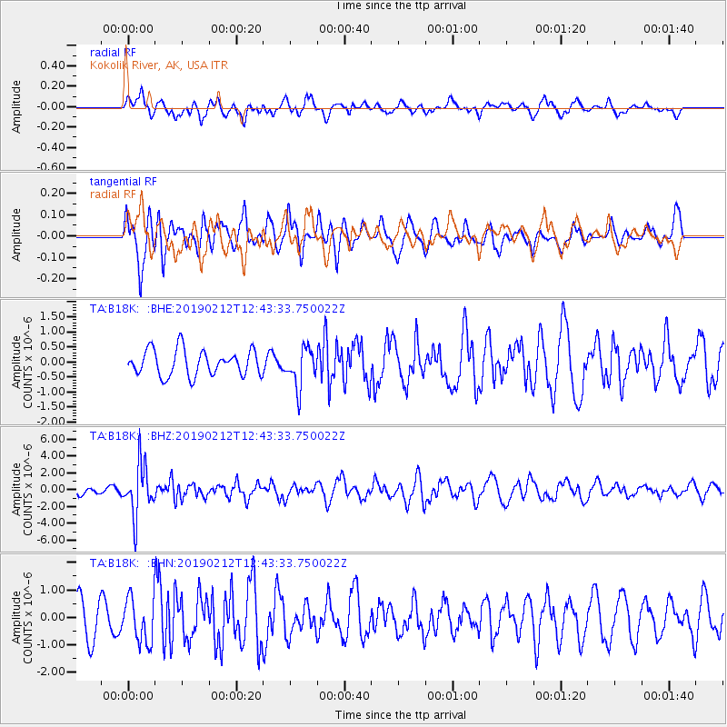
B18K Kokolik River, AK, USA - Earthquake Result Viewer
*The percent match for this event was below the threshold and hence no stack was calculated.
| Earthquake location: |
Mariana Islands |
| Earthquake latitude/longitude: |
19.1/145.8 |
| Earthquake time(UTC): |
2019/02/12 (043) 12:34:15 GMT |
| Earthquake Depth: |
130 km |
| Earthquake Magnitude: |
5.9 mww |
| Earthquake Catalog/Contributor: |
NEIC PDE/us |
|
| Network: |
TA USArray Transportable Network (new EarthScope stations) |
| Station: |
B18K Kokolik River, AK, USA |
| Lat/Lon: |
69.36 N/161.80 W |
| Elevation: |
222 m |
|
| Distance: |
59.5 deg |
| Az: |
19.04 deg |
| Baz: |
240.5 deg |
| Ray Param: |
$rayparam |
*The percent match for this event was below the threshold and hence was not used in the summary stack. |
|
| Radial Match: |
61.517242 % |
| Radial Bump: |
400 |
| Transverse Match: |
54.533096 % |
| Transverse Bump: |
400 |
| SOD ConfigId: |
13570011 |
| Insert Time: |
2019-05-02 12:47:28.377 +0000 |
| GWidth: |
2.5 |
| Max Bumps: |
400 |
| Tol: |
0.001 |
|
Signal To Noise
| Channel | StoN | STA | LTA |
| TA:B18K: :BHZ:20190212T12:43:33.750022Z | 5.2109118 | 3.0810554E-6 | 5.9126995E-7 |
| TA:B18K: :BHN:20190212T12:43:33.750022Z | 1.3816242 | 8.1983364E-7 | 5.933839E-7 |
| TA:B18K: :BHE:20190212T12:43:33.750022Z | 1.5109814 | 6.4875474E-7 | 4.2935983E-7 |
| Arrivals |
| Ps | |
| PpPs | |
| PsPs/PpSs | |


