You are here: Home > Network List > TA - USArray Transportable Network (new EarthScope stations) Stations List
> Station M26A McRoberts Ranch, Bridgeport, NE, USA > Earthquake Result Viewer
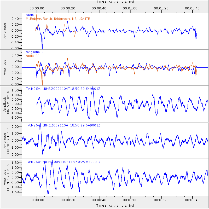
M26A McRoberts Ranch, Bridgeport, NE, USA - Earthquake Result Viewer
*The percent match for this event was below the threshold and hence no stack was calculated.
| Earthquake location: |
Azores Islands Region |
| Earthquake latitude/longitude: |
36.2/-33.9 |
| Earthquake time(UTC): |
2009/11/04 (308) 18:41:44 GMT |
| Earthquake Depth: |
10 km |
| Earthquake Magnitude: |
5.7 MB, 5.6 MS, 5.9 MW, 5.8 MW |
| Earthquake Catalog/Contributor: |
WHDF/NEIC |
|
| Network: |
TA USArray Transportable Network (new EarthScope stations) |
| Station: |
M26A McRoberts Ranch, Bridgeport, NE, USA |
| Lat/Lon: |
41.47 N/103.14 W |
| Elevation: |
1348 m |
|
| Distance: |
52.9 deg |
| Az: |
298.247 deg |
| Baz: |
71.555 deg |
| Ray Param: |
$rayparam |
*The percent match for this event was below the threshold and hence was not used in the summary stack. |
|
| Radial Match: |
56.768257 % |
| Radial Bump: |
379 |
| Transverse Match: |
76.80171 % |
| Transverse Bump: |
369 |
| SOD ConfigId: |
2622 |
| Insert Time: |
2010-03-06 20:05:34.177 +0000 |
| GWidth: |
2.5 |
| Max Bumps: |
400 |
| Tol: |
0.001 |
|
Signal To Noise
| Channel | StoN | STA | LTA |
| TA:M26A: :BHZ:20091104T18:50:29.649001Z | 3.7756717 | 1.3266457E-6 | 3.513668E-7 |
| TA:M26A: :BHN:20091104T18:50:29.649001Z | 1.5635743 | 6.744531E-7 | 4.313534E-7 |
| TA:M26A: :BHE:20091104T18:50:29.649001Z | 1.5743597 | 8.6261934E-7 | 5.479176E-7 |
| Arrivals |
| Ps | |
| PpPs | |
| PsPs/PpSs | |


