You are here: Home > Network List > TA - USArray Transportable Network (new EarthScope stations) Stations List
> Station F26K Sheenjek River, AK, USA > Earthquake Result Viewer
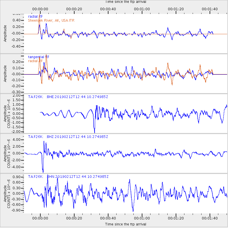
F26K Sheenjek River, AK, USA - Earthquake Result Viewer
*The percent match for this event was below the threshold and hence no stack was calculated.
| Earthquake location: |
Mariana Islands |
| Earthquake latitude/longitude: |
19.1/145.8 |
| Earthquake time(UTC): |
2019/02/12 (043) 12:34:15 GMT |
| Earthquake Depth: |
130 km |
| Earthquake Magnitude: |
5.9 mww |
| Earthquake Catalog/Contributor: |
NEIC PDE/us |
|
| Network: |
TA USArray Transportable Network (new EarthScope stations) |
| Station: |
F26K Sheenjek River, AK, USA |
| Lat/Lon: |
67.69 N/144.15 W |
| Elevation: |
683 m |
|
| Distance: |
65.0 deg |
| Az: |
23.336 deg |
| Baz: |
258.941 deg |
| Ray Param: |
$rayparam |
*The percent match for this event was below the threshold and hence was not used in the summary stack. |
|
| Radial Match: |
66.65247 % |
| Radial Bump: |
360 |
| Transverse Match: |
61.656235 % |
| Transverse Bump: |
400 |
| SOD ConfigId: |
13570011 |
| Insert Time: |
2019-05-02 12:47:54.084 +0000 |
| GWidth: |
2.5 |
| Max Bumps: |
400 |
| Tol: |
0.001 |
|
Signal To Noise
| Channel | StoN | STA | LTA |
| TA:F26K: :BHZ:20190212T12:44:10.274985Z | 6.877976 | 2.0646714E-6 | 3.0018592E-7 |
| TA:F26K: :BHN:20190212T12:44:10.274985Z | 1.439359 | 3.6836383E-7 | 2.5592215E-7 |
| TA:F26K: :BHE:20190212T12:44:10.274985Z | 3.9879823 | 7.842599E-7 | 1.966558E-7 |
| Arrivals |
| Ps | |
| PpPs | |
| PsPs/PpSs | |


