You are here: Home > Network List > TA - USArray Transportable Network (new EarthScope stations) Stations List
> Station M26A McRoberts Ranch, Bridgeport, NE, USA > Earthquake Result Viewer
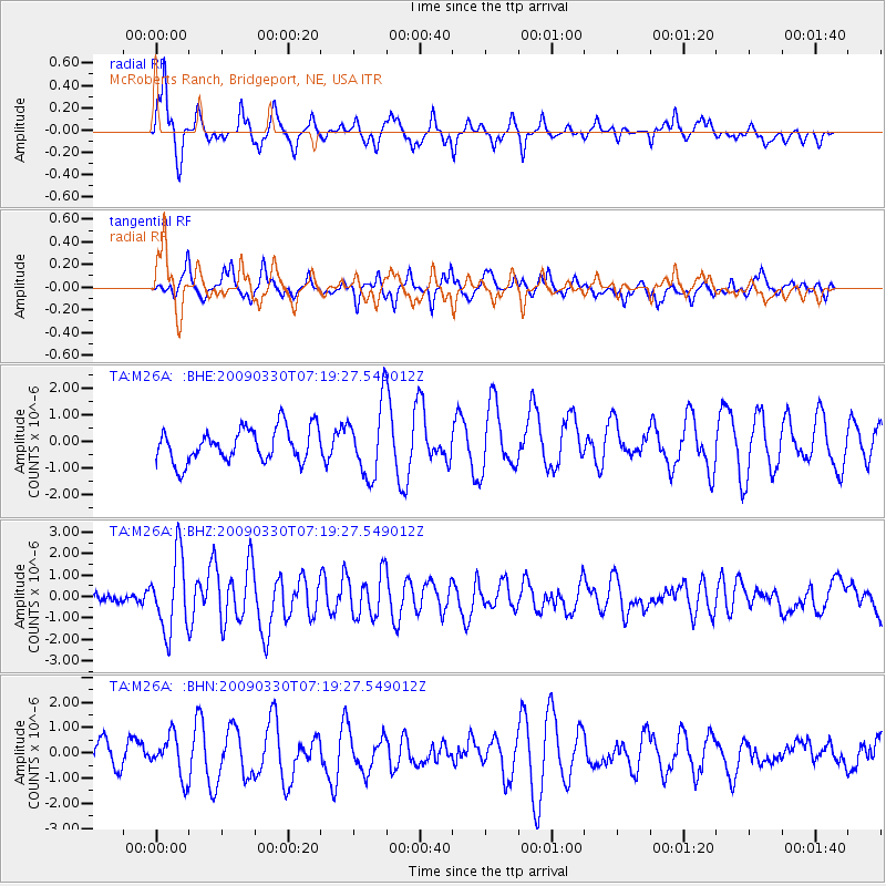
M26A McRoberts Ranch, Bridgeport, NE, USA - Earthquake Result Viewer
*The percent match for this event was below the threshold and hence no stack was calculated.
| Earthquake location: |
Kodiak Island Region, Alaska |
| Earthquake latitude/longitude: |
56.5/-152.7 |
| Earthquake time(UTC): |
2009/03/30 (089) 07:13:07 GMT |
| Earthquake Depth: |
21 km |
| Earthquake Magnitude: |
5.9 MB, 5.9 MS, 5.9 MW, 5.9 MW |
| Earthquake Catalog/Contributor: |
WHDF/NEIC |
|
| Network: |
TA USArray Transportable Network (new EarthScope stations) |
| Station: |
M26A McRoberts Ranch, Bridgeport, NE, USA |
| Lat/Lon: |
41.47 N/103.14 W |
| Elevation: |
1348 m |
|
| Distance: |
35.0 deg |
| Az: |
94.018 deg |
| Baz: |
312.682 deg |
| Ray Param: |
$rayparam |
*The percent match for this event was below the threshold and hence was not used in the summary stack. |
|
| Radial Match: |
76.39306 % |
| Radial Bump: |
400 |
| Transverse Match: |
69.43828 % |
| Transverse Bump: |
362 |
| SOD ConfigId: |
2658 |
| Insert Time: |
2010-03-06 20:05:57.136 +0000 |
| GWidth: |
2.5 |
| Max Bumps: |
400 |
| Tol: |
0.001 |
|
Signal To Noise
| Channel | StoN | STA | LTA |
| TA:M26A: :BHZ:20090330T07:19:27.549012Z | 6.0764976 | 1.7483451E-6 | 2.8772251E-7 |
| TA:M26A: :BHN:20090330T07:19:27.549012Z | 1.5496833 | 8.12924E-7 | 5.2457426E-7 |
| TA:M26A: :BHE:20090330T07:19:27.549012Z | 2.126411 | 1.3455635E-6 | 6.3278617E-7 |
| Arrivals |
| Ps | |
| PpPs | |
| PsPs/PpSs | |


