
R27A Eads, CO, USA - Earthquake Result Viewer
| ||||||||||||||||||
| ||||||||||||||||||
| ||||||||||||||||||
|
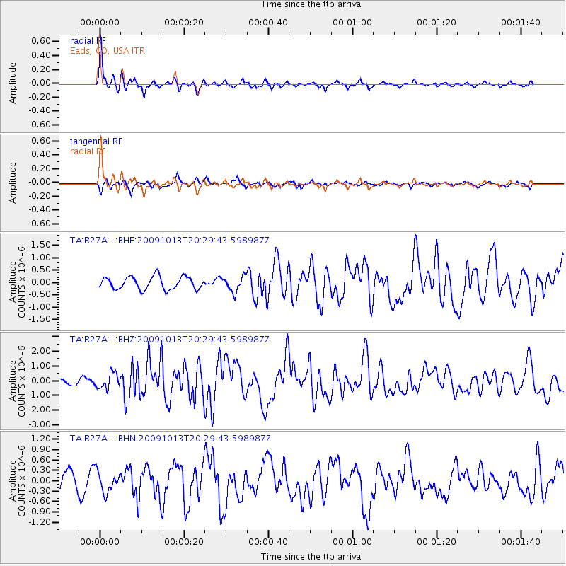
Signal To Noise
| Channel | StoN | STA | LTA |
| TA:R27A: :BHZ:20091013T20:29:43.598987Z | 3.182167 | 5.221409E-7 | 1.6408345E-7 |
| TA:R27A: :BHN:20091013T20:29:43.598987Z | 1.4593576 | 2.8711983E-7 | 1.9674398E-7 |
| TA:R27A: :BHE:20091013T20:29:43.598987Z | 1.2369312 | 3.132392E-7 | 2.5323897E-7 |
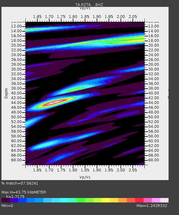
| Arrivals | |
| Ps | 5.3 SECOND |
| PpPs | 18 SECOND |
| PsPs/PpSs | 23 SECOND |

