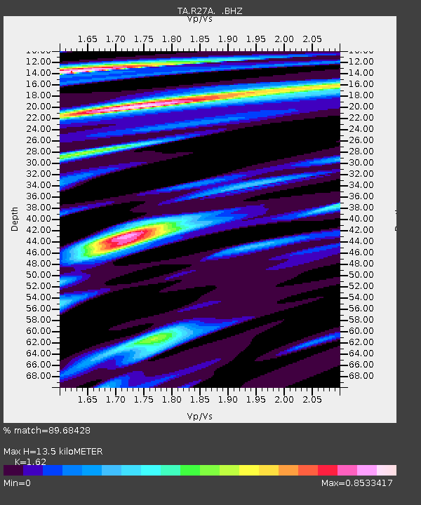
R27A Eads, CO, USA - Earthquake Result Viewer

Earthquake location: Kodiak Island Region, Alaska
Earthquake latitude/longitude: 56.5/-152.7
Earthquake time(UTC): 2009/03/30 (089) 07:13:07 GMT
Earthquake Depth: 21 km
Earthquake Magnitude: 5.9 MB, 5.9 MS, 5.9 MW, 5.9 MW
Earthquake Catalog/Contributor: WHDF/NEIC
Network: TA USArray Transportable Network (new EarthScope stations)
Station: R27A Eads, CO, USA
Lat/Lon: 38.29 N/102.80 W
Elevation: 1201 m
Distance: 37.4 deg
Az: 97.558 deg
Baz: 315.759 deg
Ray Param: 0.07611958
Estimated Moho Depth: 13.5 km
Estimated Crust Vp/Vs: 1.62
Assumed Crust Vp: 6.242 km/s
Estimated Crust Vs: 3.853 km/s
Estimated Crust Poisson's Ratio: 0.19
Radial Match: 89.68428 %
Radial Bump: 270
Transverse Match: 63.098568 %
Transverse Bump: 400
SOD ConfigId: 2658
Insert Time: 2010-03-06 20:06:47.784 +0000
GWidth: 2.5
Max Bumps: 400
Tol: 0.001

Signal To Noise

ChannelStoNSTALTA
TA:R27A: :BHZ:20090330T07:19:48.075013Z8.8085681.5751319E-61.7881815E-7
TA:R27A: :BHN:20090330T07:19:48.075013Z3.70241986.433316E-71.7375976E-7
TA:R27A: :BHE:20090330T07:19:48.075013Z4.02757365.986413E-71.4863572E-7
Arrivals
Ps1.4 SECOND
PpPs5.3 SECOND
PsPs/PpSs6.7 SECOND