You are here: Home > Network List > TA - USArray Transportable Network (new EarthScope stations) Stations List
> Station R27A Eads, CO, USA > Earthquake Result Viewer
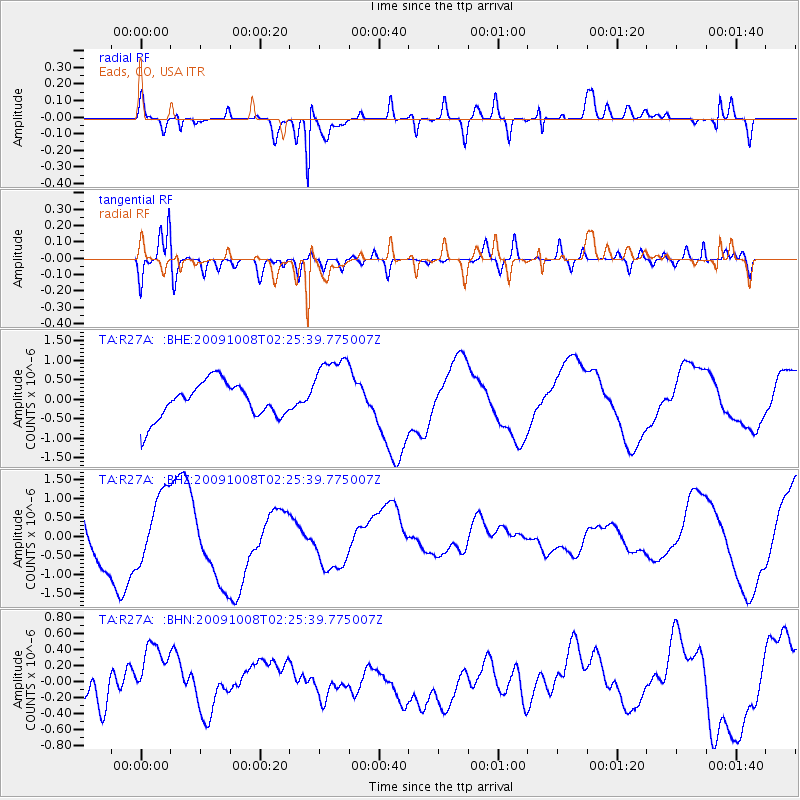
R27A Eads, CO, USA - Earthquake Result Viewer
*The percent match for this event was below the threshold and hence no stack was calculated.
| Earthquake location: |
Santa Cruz Islands |
| Earthquake latitude/longitude: |
-11.7/166.2 |
| Earthquake time(UTC): |
2009/10/08 (281) 02:12:39 GMT |
| Earthquake Depth: |
35 km |
| Earthquake Magnitude: |
5.8 MB, 6.6 MW |
| Earthquake Catalog/Contributor: |
WHDF/NEIC |
|
| Network: |
TA USArray Transportable Network (new EarthScope stations) |
| Station: |
R27A Eads, CO, USA |
| Lat/Lon: |
38.29 N/102.80 W |
| Elevation: |
1201 m |
|
| Distance: |
97.9 deg |
| Az: |
52.597 deg |
| Baz: |
261.453 deg |
| Ray Param: |
$rayparam |
*The percent match for this event was below the threshold and hence was not used in the summary stack. |
|
| Radial Match: |
80.87608 % |
| Radial Bump: |
400 |
| Transverse Match: |
70.70124 % |
| Transverse Bump: |
400 |
| SOD ConfigId: |
2622 |
| Insert Time: |
2010-03-06 20:07:20.496 +0000 |
| GWidth: |
2.5 |
| Max Bumps: |
400 |
| Tol: |
0.001 |
|
Signal To Noise
| Channel | StoN | STA | LTA |
| TA:R27A: :BHZ:20091008T02:25:39.775007Z | 1.0685376 | 9.3242113E-7 | 8.726143E-7 |
| TA:R27A: :BHN:20091008T02:25:39.775007Z | 1.8245848 | 5.01229E-7 | 2.7470853E-7 |
| TA:R27A: :BHE:20091008T02:25:39.775007Z | 2.034149 | 9.399729E-7 | 4.6209644E-7 |
| Arrivals |
| Ps | |
| PpPs | |
| PsPs/PpSs | |


