You are here: Home > Network List > TA - USArray Transportable Network (new EarthScope stations) Stations List
> Station R27A Eads, CO, USA > Earthquake Result Viewer
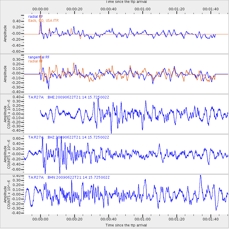
R27A Eads, CO, USA - Earthquake Result Viewer
*The percent match for this event was below the threshold and hence no stack was calculated.
| Earthquake location: |
Andreanof Islands, Aleutian Is. |
| Earthquake latitude/longitude: |
51.3/-178.2 |
| Earthquake time(UTC): |
2009/06/22 (173) 21:05:33 GMT |
| Earthquake Depth: |
29 km |
| Earthquake Magnitude: |
5.5 MB, 5.0 MS, 5.4 MW, 5.4 MW |
| Earthquake Catalog/Contributor: |
WHDF/NEIC |
|
| Network: |
TA USArray Transportable Network (new EarthScope stations) |
| Station: |
R27A Eads, CO, USA |
| Lat/Lon: |
38.29 N/102.80 W |
| Elevation: |
1201 m |
|
| Distance: |
52.8 deg |
| Az: |
72.992 deg |
| Baz: |
310.349 deg |
| Ray Param: |
$rayparam |
*The percent match for this event was below the threshold and hence was not used in the summary stack. |
|
| Radial Match: |
60.508015 % |
| Radial Bump: |
400 |
| Transverse Match: |
48.432423 % |
| Transverse Bump: |
400 |
| SOD ConfigId: |
2648 |
| Insert Time: |
2010-03-06 20:07:37.275 +0000 |
| GWidth: |
2.5 |
| Max Bumps: |
400 |
| Tol: |
0.001 |
|
Signal To Noise
| Channel | StoN | STA | LTA |
| TA:R27A: :BHZ:20090622T21:14:15.725002Z | 2.8588512 | 3.1874248E-7 | 1.1149321E-7 |
| TA:R27A: :BHN:20090622T21:14:15.725002Z | 1.2077885 | 1.1764196E-7 | 9.740278E-8 |
| TA:R27A: :BHE:20090622T21:14:15.725002Z | 2.2252152 | 1.8792618E-7 | 8.4453035E-8 |
| Arrivals |
| Ps | |
| PpPs | |
| PsPs/PpSs | |


