L21A Rawlins, WY, USA - Earthquake Result Viewer
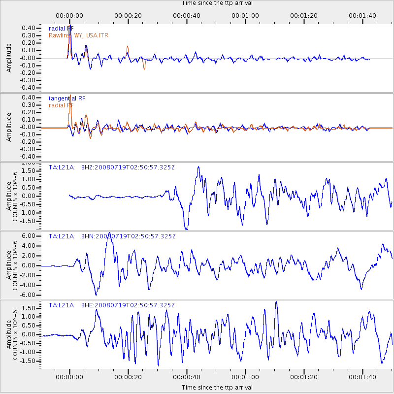
Earthquake location: Off East Coast Of Honshu, Japan
Earthquake latitude/longitude: 37.6/142.2
Earthquake time(UTC): 2008/07/19 (201) 02:39:28 GMT
Earthquake Depth: 22 km
Earthquake Magnitude: 6.2 MB, 7.0 MS, 7.0 MW, 6.9 MW
Earthquake Catalog/Contributor: WHDF/NEIC
Network: TA USArray Transportable Network (new EarthScope stations)
Station: L21A Rawlins, WY, USA
Lat/Lon: 41.96 N/107.37 W
Elevation: 2065 m
Distance: 78.6 deg
Az: 45.479 deg
Baz: 310.552 deg
Ray Param: 0.049503952
Estimated Moho Depth: 12.25 km
Estimated Crust Vp/Vs: 1.91
Assumed Crust Vp: 6.159 km/s
Estimated Crust Vs: 3.224 km/s
Estimated Crust Poisson's Ratio: 0.31
Radial Match: 96.32375 %
Radial Bump: 400
Transverse Match: 89.40942 %
Transverse Bump: 400
SOD ConfigId: 2504
Insert Time: 2010-03-06 20:07:52.296 +0000
GWidth: 2.5
Max Bumps: 400
Tol: 0.001

Signal To Noise

ChannelStoNSTALTA
TA:L21A: :BHN:20080719T02:50:57.325Z9.9990557.270988E-77.271675E-8
TA:L21A: :BHE:20080719T02:50:57.325Z4.3070571.5804252E-73.6693855E-8
TA:L21A: :BHZ:20080719T02:50:57.325Z3.92603091.8742587E-74.7739277E-8
Arrivals
Ps1.9 SECOND
PpPs5.6 SECOND
PsPs/PpSs7.5 SECOND