L21A Rawlins, WY, USA - Earthquake Result Viewer
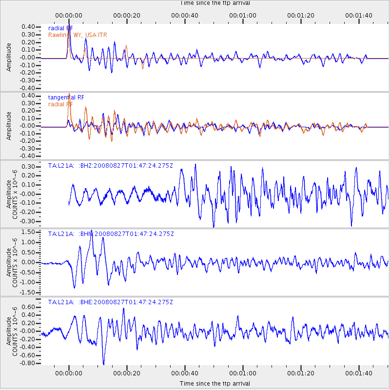
Earthquake location: Lake Baykal Region, Russia
Earthquake latitude/longitude: 51.6/104.2
Earthquake time(UTC): 2008/08/27 (240) 01:35:32 GMT
Earthquake Depth: 16 km
Earthquake Magnitude: 5.8 MB, 6.2 MS, 6.2 MW, 6.2 MW
Earthquake Catalog/Contributor: WHDF/NEIC
Network: TA USArray Transportable Network (new EarthScope stations)
Station: L21A Rawlins, WY, USA
Lat/Lon: 41.96 N/107.37 W
Elevation: 2065 m
Distance: 82.9 deg
Az: 23.143 deg
Baz: 340.814 deg
Ray Param: 0.04658536
Estimated Moho Depth: 51.5 km
Estimated Crust Vp/Vs: 1.69
Assumed Crust Vp: 6.159 km/s
Estimated Crust Vs: 3.65 km/s
Estimated Crust Poisson's Ratio: 0.23
Radial Match: 83.45578 %
Radial Bump: 400
Transverse Match: 76.24574 %
Transverse Bump: 400
SOD ConfigId: 2504
Insert Time: 2010-03-06 20:08:12.639 +0000
GWidth: 2.5
Max Bumps: 400
Tol: 0.001

Signal To Noise

ChannelStoNSTALTA
TA:L21A: :BHN:20080827T01:47:24.275Z12.9311185.96383E-74.611999E-8
TA:L21A: :BHE:20080827T01:47:24.275Z3.95336062.1777932E-75.5087135E-8
TA:L21A: :BHZ:20080827T01:47:24.275Z0.601459563.4389195E-85.717624E-8
Arrivals
Ps5.9 SECOND
PpPs22 SECOND
PsPs/PpSs28 SECOND