
L21A Rawlins, WY, USA - Earthquake Result Viewer
| ||||||||||||||||||
| ||||||||||||||||||
| ||||||||||||||||||
|
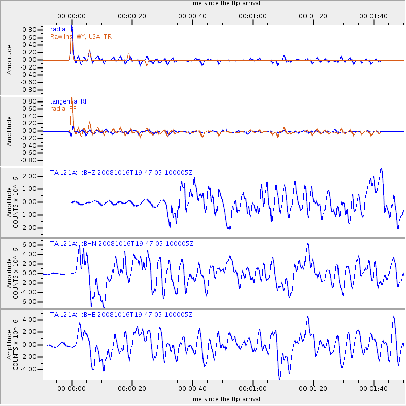
Signal To Noise
| Channel | StoN | STA | LTA |
| TA:L21A: :BHN:20081016T19:47:05.100005Z | 26.605366 | 2.753288E-6 | 1.034862E-7 |
| TA:L21A: :BHE:20081016T19:47:05.100005Z | 9.441341 | 1.6899038E-6 | 1.7898981E-7 |
| TA:L21A: :BHZ:20081016T19:47:05.100005Z | 7.4182158 | 8.6824184E-7 | 1.1704187E-7 |
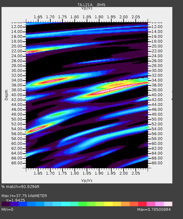
| Arrivals | |
| Ps | 6.2 SECOND |
| PpPs | 17 SECOND |
| PsPs/PpSs | 23 SECOND |

