
L21A Rawlins, WY, USA - Earthquake Result Viewer
| ||||||||||||||||||
| ||||||||||||||||||
| ||||||||||||||||||
|
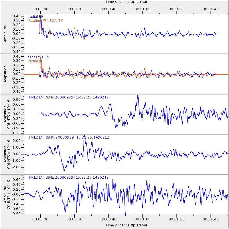
Signal To Noise
| Channel | StoN | STA | LTA |
| TA:L21A: :BHN:20080929T15:32:25.149021Z | 6.876122 | 4.377026E-7 | 6.365544E-8 |
| TA:L21A: :BHE:20080929T15:32:25.149021Z | 1.633152 | 1.4162235E-7 | 8.6717186E-8 |
| TA:L21A: :BHZ:20080929T15:32:25.149021Z | 1.4223908 | 1.07712204E-7 | 7.572616E-8 |
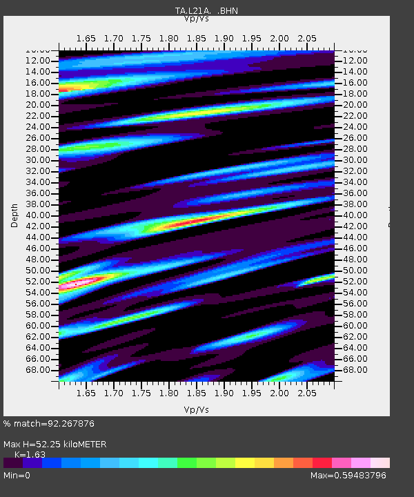
| Arrivals | |
| Ps | 5.5 SECOND |
| PpPs | 22 SECOND |
| PsPs/PpSs | 27 SECOND |

