You are here: Home > Network List > TA - USArray Transportable Network (new EarthScope stations) Stations List
> Station F21K Alatna River, AK, USA > Earthquake Result Viewer
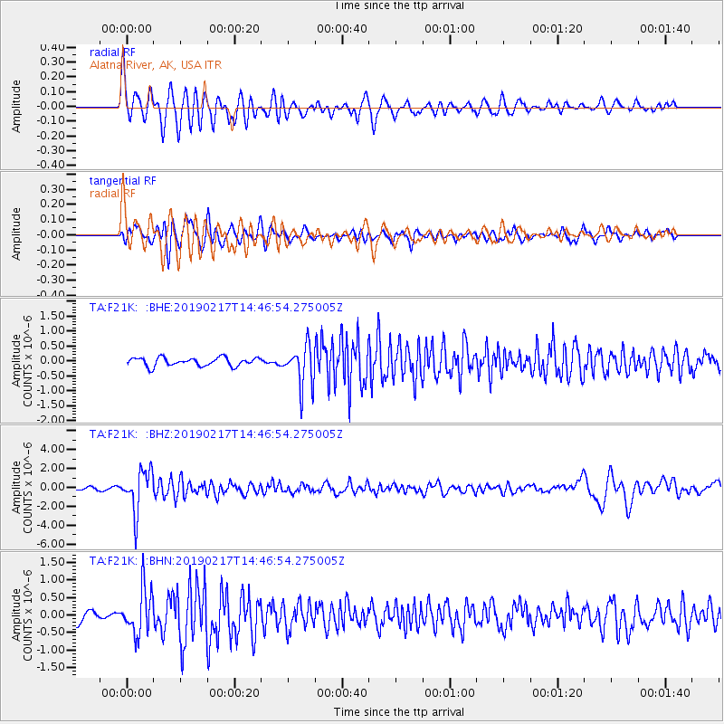
F21K Alatna River, AK, USA - Earthquake Result Viewer
*The percent match for this event was below the threshold and hence no stack was calculated.
| Earthquake location: |
New Ireland Region, P.N.G. |
| Earthquake latitude/longitude: |
-3.4/152.1 |
| Earthquake time(UTC): |
2019/02/17 (048) 14:35:56 GMT |
| Earthquake Depth: |
368 km |
| Earthquake Magnitude: |
6.4 Mww |
| Earthquake Catalog/Contributor: |
NEIC PDE/us |
|
| Network: |
TA USArray Transportable Network (new EarthScope stations) |
| Station: |
F21K Alatna River, AK, USA |
| Lat/Lon: |
67.22 N/153.48 W |
| Elevation: |
597 m |
|
| Distance: |
80.1 deg |
| Az: |
18.75 deg |
| Baz: |
235.497 deg |
| Ray Param: |
$rayparam |
*The percent match for this event was below the threshold and hence was not used in the summary stack. |
|
| Radial Match: |
77.353096 % |
| Radial Bump: |
400 |
| Transverse Match: |
59.465412 % |
| Transverse Bump: |
400 |
| SOD ConfigId: |
13570011 |
| Insert Time: |
2019-05-02 13:22:09.842 +0000 |
| GWidth: |
2.5 |
| Max Bumps: |
400 |
| Tol: |
0.001 |
|
Signal To Noise
| Channel | StoN | STA | LTA |
| TA:F21K: :BHZ:20190217T14:46:54.275005Z | 14.292474 | 2.217146E-6 | 1.5512681E-7 |
| TA:F21K: :BHN:20190217T14:46:54.275005Z | 3.8343017 | 6.530426E-7 | 1.7031591E-7 |
| TA:F21K: :BHE:20190217T14:46:54.275005Z | 5.1974854 | 7.2298667E-7 | 1.3910316E-7 |
| Arrivals |
| Ps | |
| PpPs | |
| PsPs/PpSs | |


