You are here: Home > Network List > TA - USArray Transportable Network (new EarthScope stations) Stations List
> Station L21A Rawlins, WY, USA > Earthquake Result Viewer
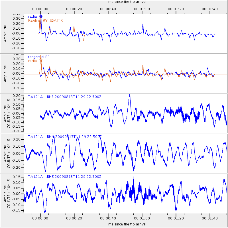
L21A Rawlins, WY, USA - Earthquake Result Viewer
*The percent match for this event was below the threshold and hence no stack was calculated.
| Earthquake location: |
Tonga Islands |
| Earthquake latitude/longitude: |
-21.7/-174.6 |
| Earthquake time(UTC): |
2009/08/13 (225) 11:17:01 GMT |
| Earthquake Depth: |
10 km |
| Earthquake Magnitude: |
5.6 MW, 5.3 MB |
| Earthquake Catalog/Contributor: |
WHDF/NEIC |
|
| Network: |
TA USArray Transportable Network (new EarthScope stations) |
| Station: |
L21A Rawlins, WY, USA |
| Lat/Lon: |
41.96 N/107.37 W |
| Elevation: |
2065 m |
|
| Distance: |
88.6 deg |
| Az: |
43.448 deg |
| Baz: |
239.067 deg |
| Ray Param: |
$rayparam |
*The percent match for this event was below the threshold and hence was not used in the summary stack. |
|
| Radial Match: |
74.31441 % |
| Radial Bump: |
400 |
| Transverse Match: |
50.611877 % |
| Transverse Bump: |
400 |
| SOD ConfigId: |
2622 |
| Insert Time: |
2010-03-06 20:11:08.805 +0000 |
| GWidth: |
2.5 |
| Max Bumps: |
400 |
| Tol: |
0.001 |
|
Signal To Noise
| Channel | StoN | STA | LTA |
| TA:L21A: :BHN:20090813T11:29:22.500Z | 2.7296562 | 1.1846361E-7 | 4.3398728E-8 |
| TA:L21A: :BHE:20090813T11:29:22.500Z | 2.0925121 | 8.578342E-8 | 4.0995424E-8 |
| TA:L21A: :BHZ:20090813T11:29:22.500Z | 1.5174104 | 4.107688E-8 | 2.7070383E-8 |
| Arrivals |
| Ps | |
| PpPs | |
| PsPs/PpSs | |


