You are here: Home > Network List > TA - USArray Transportable Network (new EarthScope stations) Stations List
> Station L21A Rawlins, WY, USA > Earthquake Result Viewer
L21A Rawlins, WY, USA - Earthquake Result Viewer
*The percent match for this event was below the threshold and hence no stack was calculated.
| Earthquake location: |
Peru-Bolivia Border Region |
| Earthquake latitude/longitude: |
-15.6/-69.3 |
| Earthquake time(UTC): |
2009/09/30 (273) 19:03:17 GMT |
| Earthquake Depth: |
255 km |
| Earthquake Magnitude: |
5.9 MB, 5.8 MW |
| Earthquake Catalog/Contributor: |
WHDF/NEIC |
|
| Network: |
TA USArray Transportable Network (new EarthScope stations) |
| Station: |
L21A Rawlins, WY, USA |
| Lat/Lon: |
41.96 N/107.37 W |
| Elevation: |
2065 m |
|
| Distance: |
67.1 deg |
| Az: |
330.058 deg |
| Baz: |
139.83 deg |
| Ray Param: |
$rayparam |
*The percent match for this event was below the threshold and hence was not used in the summary stack. |
|
| Radial Match: |
72.874405 % |
| Radial Bump: |
400 |
| Transverse Match: |
62.8301 % |
| Transverse Bump: |
400 |
| SOD ConfigId: |
2622 |
| Insert Time: |
2010-03-06 20:11:23.490 +0000 |
| GWidth: |
2.5 |
| Max Bumps: |
400 |
| Tol: |
0.001 |
|
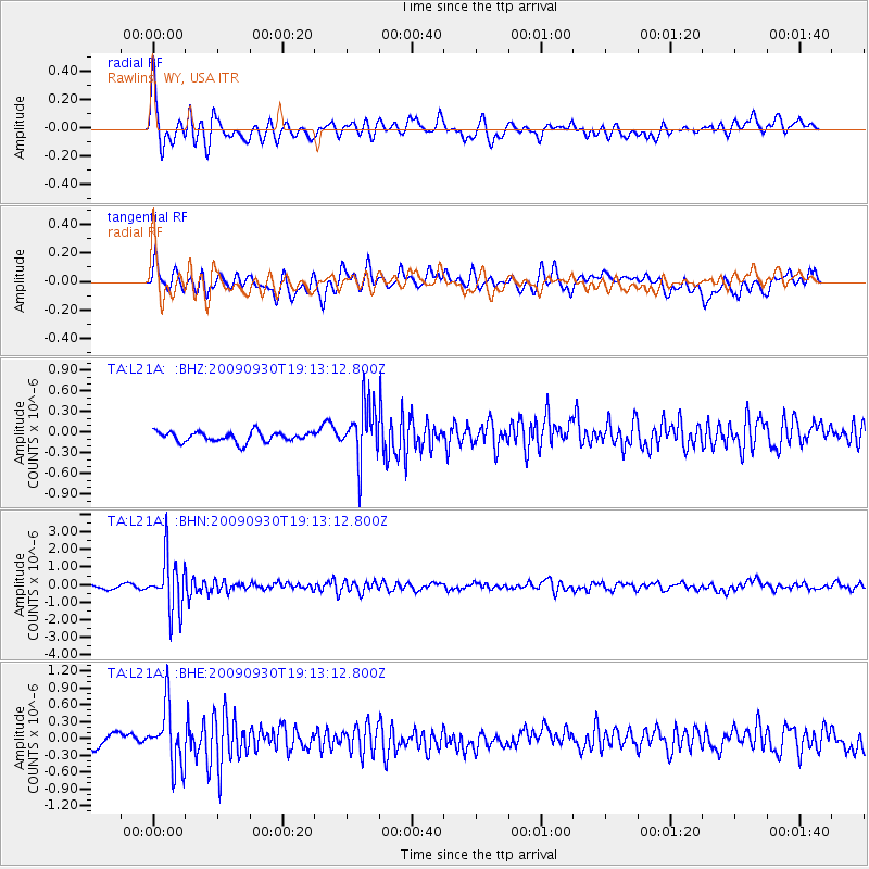
Signal To Noise
| Channel | StoN | STA | LTA |
| TA:L21A: :BHN:20090930T19:13:12.800Z | 15.557261 | 1.5032841E-6 | 9.6629094E-8 |
| TA:L21A: :BHE:20090930T19:13:12.800Z | 4.253122 | 5.253319E-7 | 1.2351678E-7 |
| TA:L21A: :BHZ:20090930T19:13:12.800Z | 5.500434 | 4.0537765E-7 | 7.369921E-8 |
| Arrivals |
| Ps | |
| PpPs | |
| PsPs/PpSs | |


