You are here: Home > Network List > TA - USArray Transportable Network (new EarthScope stations) Stations List
> Station L21A Rawlins, WY, USA > Earthquake Result Viewer
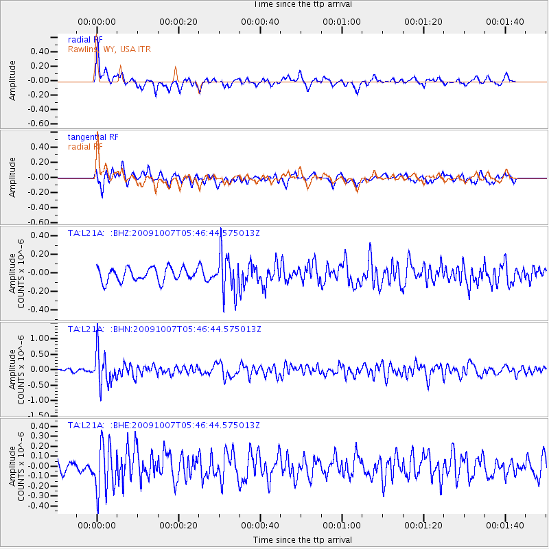
L21A Rawlins, WY, USA - Earthquake Result Viewer
*The percent match for this event was below the threshold and hence no stack was calculated.
| Earthquake location: |
Rat Islands, Aleutian Islands |
| Earthquake latitude/longitude: |
52.2/178.1 |
| Earthquake time(UTC): |
2009/10/07 (280) 05:38:37 GMT |
| Earthquake Depth: |
138 km |
| Earthquake Magnitude: |
5.6 MB, 5.6 MW, 5.6 MW |
| Earthquake Catalog/Contributor: |
WHDF/NEIC |
|
| Network: |
TA USArray Transportable Network (new EarthScope stations) |
| Station: |
L21A Rawlins, WY, USA |
| Lat/Lon: |
41.96 N/107.37 W |
| Elevation: |
2065 m |
|
| Distance: |
49.7 deg |
| Az: |
70.528 deg |
| Baz: |
308.848 deg |
| Ray Param: |
$rayparam |
*The percent match for this event was below the threshold and hence was not used in the summary stack. |
|
| Radial Match: |
73.66367 % |
| Radial Bump: |
378 |
| Transverse Match: |
61.429413 % |
| Transverse Bump: |
400 |
| SOD ConfigId: |
2622 |
| Insert Time: |
2010-03-06 20:11:24.766 +0000 |
| GWidth: |
2.5 |
| Max Bumps: |
400 |
| Tol: |
0.001 |
|
Signal To Noise
| Channel | StoN | STA | LTA |
| TA:L21A: :BHN:20091007T05:46:44.575013Z | 6.6714754 | 5.318072E-7 | 7.971358E-8 |
| TA:L21A: :BHE:20091007T05:46:44.575013Z | 2.9119134 | 2.3686573E-7 | 8.134367E-8 |
| TA:L21A: :BHZ:20091007T05:46:44.575013Z | 3.0016346 | 2.1342146E-7 | 7.1101745E-8 |
| Arrivals |
| Ps | |
| PpPs | |
| PsPs/PpSs | |


