You are here: Home > Network List > TA - USArray Transportable Network (new EarthScope stations) Stations List
> Station L21A Rawlins, WY, USA > Earthquake Result Viewer
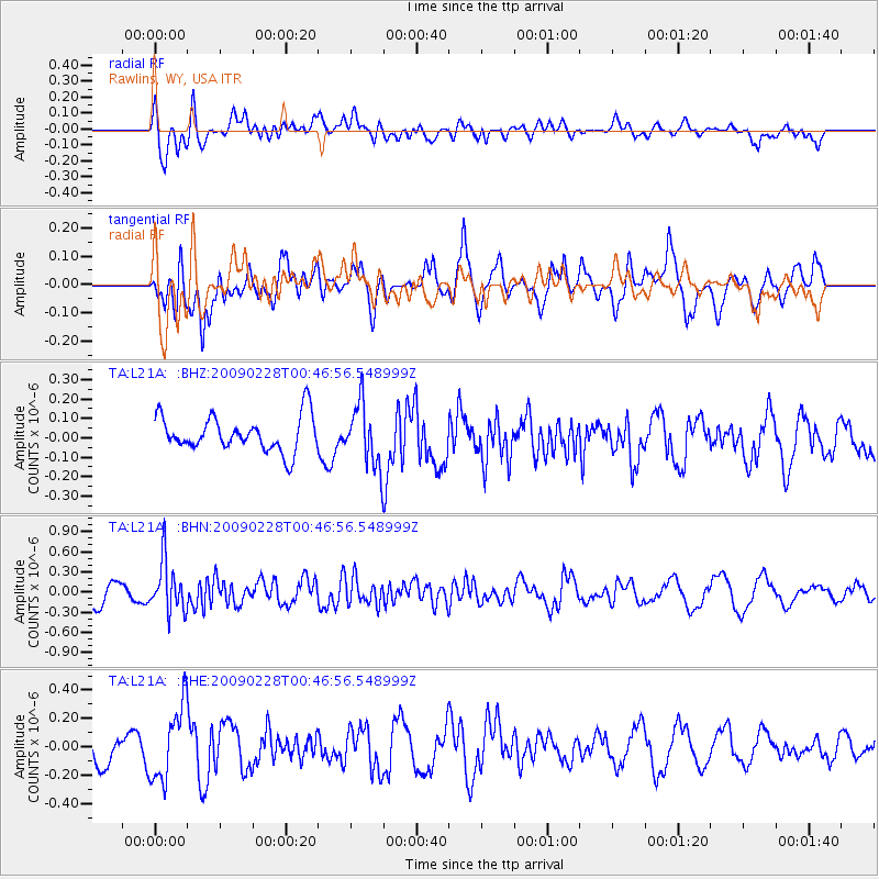
L21A Rawlins, WY, USA - Earthquake Result Viewer
*The percent match for this event was below the threshold and hence no stack was calculated.
| Earthquake location: |
Hokkaido, Japan Region |
| Earthquake latitude/longitude: |
42.6/142.1 |
| Earthquake time(UTC): |
2009/02/28 (059) 00:35:56 GMT |
| Earthquake Depth: |
105 km |
| Earthquake Magnitude: |
5.5 MB, 5.5 MW, 5.5 MW |
| Earthquake Catalog/Contributor: |
WHDF/NEIC |
|
| Network: |
TA USArray Transportable Network (new EarthScope stations) |
| Station: |
L21A Rawlins, WY, USA |
| Lat/Lon: |
41.96 N/107.37 W |
| Elevation: |
2065 m |
|
| Distance: |
75.1 deg |
| Az: |
46.268 deg |
| Baz: |
314.335 deg |
| Ray Param: |
$rayparam |
*The percent match for this event was below the threshold and hence was not used in the summary stack. |
|
| Radial Match: |
58.136818 % |
| Radial Bump: |
400 |
| Transverse Match: |
48.096622 % |
| Transverse Bump: |
400 |
| SOD ConfigId: |
2658 |
| Insert Time: |
2010-03-06 20:11:28.497 +0000 |
| GWidth: |
2.5 |
| Max Bumps: |
400 |
| Tol: |
0.001 |
|
Signal To Noise
| Channel | StoN | STA | LTA |
| TA:L21A: :BHN:20090228T00:46:56.548999Z | 2.5077765 | 3.8043174E-7 | 1.5170082E-7 |
| TA:L21A: :BHE:20090228T00:46:56.548999Z | 3.3880332 | 2.604341E-7 | 7.686882E-8 |
| TA:L21A: :BHZ:20090228T00:46:56.548999Z | 1.7944149 | 1.6131614E-7 | 8.989902E-8 |
| Arrivals |
| Ps | |
| PpPs | |
| PsPs/PpSs | |


