You are here: Home > Network List > TA - USArray Transportable Network (new EarthScope stations) Stations List
> Station L21A Rawlins, WY, USA > Earthquake Result Viewer
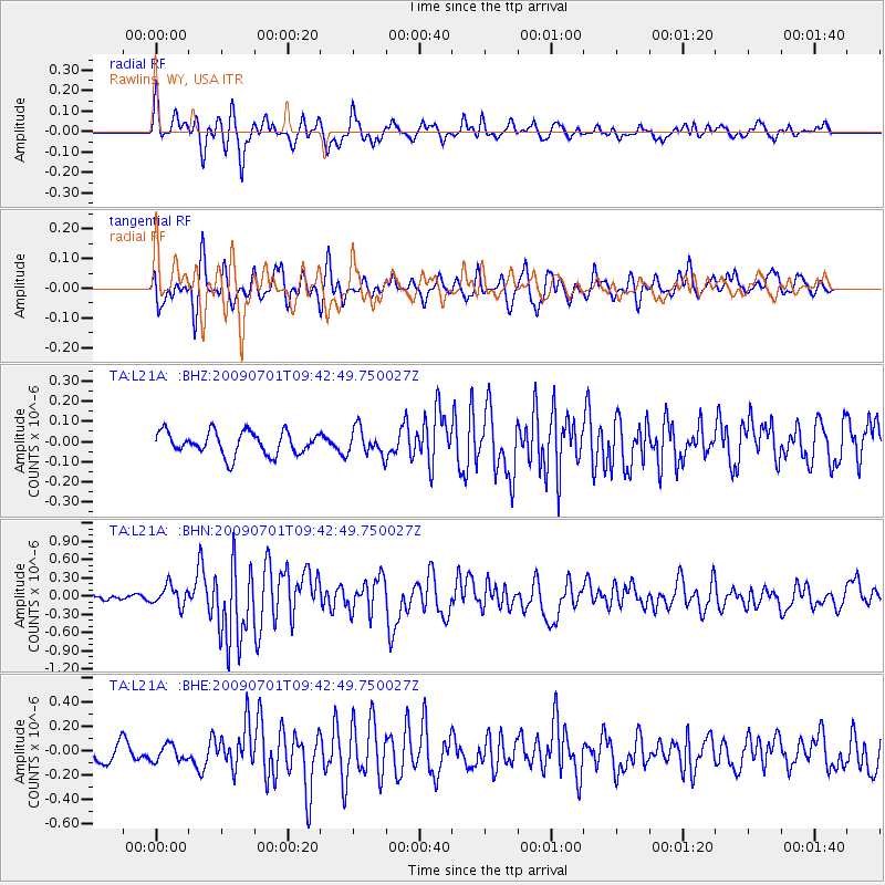
L21A Rawlins, WY, USA - Earthquake Result Viewer
*The percent match for this event was below the threshold and hence no stack was calculated.
| Earthquake location: |
Crete, Greece |
| Earthquake latitude/longitude: |
34.2/25.5 |
| Earthquake time(UTC): |
2009/07/01 (182) 09:30:10 GMT |
| Earthquake Depth: |
19 km |
| Earthquake Magnitude: |
6.1 MB, 6.3 MS, 6.4 MW, 6.4 MW |
| Earthquake Catalog/Contributor: |
WHDF/NEIC |
|
| Network: |
TA USArray Transportable Network (new EarthScope stations) |
| Station: |
L21A Rawlins, WY, USA |
| Lat/Lon: |
41.96 N/107.37 W |
| Elevation: |
2065 m |
|
| Distance: |
92.8 deg |
| Az: |
326.805 deg |
| Baz: |
37.496 deg |
| Ray Param: |
$rayparam |
*The percent match for this event was below the threshold and hence was not used in the summary stack. |
|
| Radial Match: |
73.2662 % |
| Radial Bump: |
400 |
| Transverse Match: |
72.97559 % |
| Transverse Bump: |
400 |
| SOD ConfigId: |
2648 |
| Insert Time: |
2010-03-06 20:11:47.805 +0000 |
| GWidth: |
2.5 |
| Max Bumps: |
400 |
| Tol: |
0.001 |
|
Signal To Noise
| Channel | StoN | STA | LTA |
| TA:L21A: :BHN:20090701T09:42:49.750027Z | 2.5825758 | 1.6557007E-7 | 6.411044E-8 |
| TA:L21A: :BHE:20090701T09:42:49.750027Z | 0.79111147 | 6.9862985E-8 | 8.830992E-8 |
| TA:L21A: :BHZ:20090701T09:42:49.750027Z | 1.1599745 | 6.541133E-8 | 5.639032E-8 |
| Arrivals |
| Ps | |
| PpPs | |
| PsPs/PpSs | |


