You are here: Home > Network List > TA - USArray Transportable Network (new EarthScope stations) Stations List
> Station L21A Rawlins, WY, USA > Earthquake Result Viewer
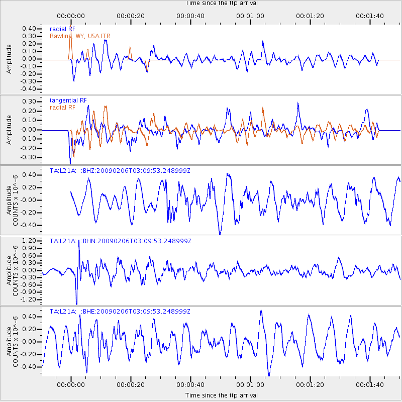
L21A Rawlins, WY, USA - Earthquake Result Viewer
*The percent match for this event was below the threshold and hence no stack was calculated.
| Earthquake location: |
Near Coast Of Northern Chile |
| Earthquake latitude/longitude: |
-28.0/-71.1 |
| Earthquake time(UTC): |
2009/02/06 (037) 02:58:35 GMT |
| Earthquake Depth: |
52 km |
| Earthquake Magnitude: |
5.5 MB |
| Earthquake Catalog/Contributor: |
WHDF/NEIC |
|
| Network: |
TA USArray Transportable Network (new EarthScope stations) |
| Station: |
L21A Rawlins, WY, USA |
| Lat/Lon: |
41.96 N/107.37 W |
| Elevation: |
2065 m |
|
| Distance: |
77.2 deg |
| Az: |
333.107 deg |
| Baz: |
147.564 deg |
| Ray Param: |
$rayparam |
*The percent match for this event was below the threshold and hence was not used in the summary stack. |
|
| Radial Match: |
61.187 % |
| Radial Bump: |
400 |
| Transverse Match: |
60.855637 % |
| Transverse Bump: |
400 |
| SOD ConfigId: |
2658 |
| Insert Time: |
2010-03-06 20:12:23.087 +0000 |
| GWidth: |
2.5 |
| Max Bumps: |
400 |
| Tol: |
0.001 |
|
Signal To Noise
| Channel | StoN | STA | LTA |
| TA:L21A: :BHN:20090206T03:09:53.248999Z | 2.6356611 | 4.965952E-7 | 1.884139E-7 |
| TA:L21A: :BHE:20090206T03:09:53.248999Z | 1.4276669 | 1.86524E-7 | 1.3064952E-7 |
| TA:L21A: :BHZ:20090206T03:09:53.248999Z | 1.3207604 | 2.390484E-7 | 1.8099303E-7 |
| Arrivals |
| Ps | |
| PpPs | |
| PsPs/PpSs | |


