You are here: Home > Network List > TA - USArray Transportable Network (new EarthScope stations) Stations List
> Station L21A Rawlins, WY, USA > Earthquake Result Viewer
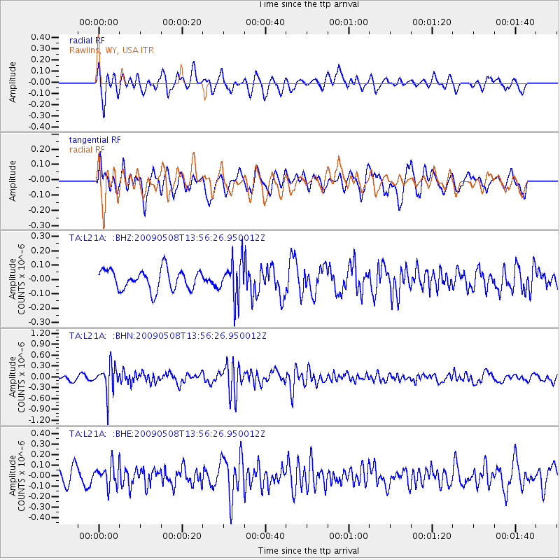
L21A Rawlins, WY, USA - Earthquake Result Viewer
*The percent match for this event was below the threshold and hence no stack was calculated.
| Earthquake location: |
Mendoza Province, Argentina |
| Earthquake latitude/longitude: |
-32.1/-69.7 |
| Earthquake time(UTC): |
2009/05/08 (128) 13:44:53 GMT |
| Earthquake Depth: |
112 km |
| Earthquake Magnitude: |
5.6 MB, 5.4 MW |
| Earthquake Catalog/Contributor: |
WHDF/NEIC |
|
| Network: |
TA USArray Transportable Network (new EarthScope stations) |
| Station: |
L21A Rawlins, WY, USA |
| Lat/Lon: |
41.96 N/107.37 W |
| Elevation: |
2065 m |
|
| Distance: |
81.4 deg |
| Az: |
332.539 deg |
| Baz: |
148.329 deg |
| Ray Param: |
$rayparam |
*The percent match for this event was below the threshold and hence was not used in the summary stack. |
|
| Radial Match: |
65.66658 % |
| Radial Bump: |
400 |
| Transverse Match: |
57.275223 % |
| Transverse Bump: |
400 |
| SOD ConfigId: |
2658 |
| Insert Time: |
2010-03-06 20:12:29.222 +0000 |
| GWidth: |
2.5 |
| Max Bumps: |
400 |
| Tol: |
0.001 |
|
Signal To Noise
| Channel | StoN | STA | LTA |
| TA:L21A: :BHN:20090508T13:56:26.950012Z | 5.566281 | 3.9640423E-7 | 7.1215275E-8 |
| TA:L21A: :BHE:20090508T13:56:26.950012Z | 1.4832193 | 1.02670505E-7 | 6.92214E-8 |
| TA:L21A: :BHZ:20090508T13:56:26.950012Z | 1.8786073 | 1.3106174E-7 | 6.976538E-8 |
| Arrivals |
| Ps | |
| PpPs | |
| PsPs/PpSs | |


