You are here: Home > Network List > TA - USArray Transportable Network (new EarthScope stations) Stations List
> Station L21A Rawlins, WY, USA > Earthquake Result Viewer
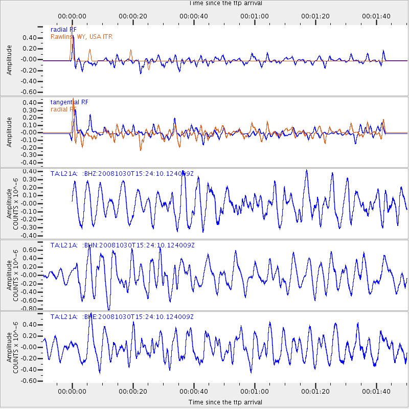
L21A Rawlins, WY, USA - Earthquake Result Viewer
*The percent match for this event was below the threshold and hence no stack was calculated.
| Earthquake location: |
Central East Pacific Rise |
| Earthquake latitude/longitude: |
-9.0/-108.2 |
| Earthquake time(UTC): |
2008/10/30 (304) 15:15:41 GMT |
| Earthquake Depth: |
10 km |
| Earthquake Magnitude: |
5.5 MB, 5.8 MS, 6.0 MW, 6.0 MW |
| Earthquake Catalog/Contributor: |
WHDF/NEIC |
|
| Network: |
TA USArray Transportable Network (new EarthScope stations) |
| Station: |
L21A Rawlins, WY, USA |
| Lat/Lon: |
41.96 N/107.37 W |
| Elevation: |
2065 m |
|
| Distance: |
50.7 deg |
| Az: |
0.844 deg |
| Baz: |
181.118 deg |
| Ray Param: |
$rayparam |
*The percent match for this event was below the threshold and hence was not used in the summary stack. |
|
| Radial Match: |
65.99873 % |
| Radial Bump: |
400 |
| Transverse Match: |
62.176163 % |
| Transverse Bump: |
400 |
| SOD ConfigId: |
2560 |
| Insert Time: |
2010-03-06 20:12:38.025 +0000 |
| GWidth: |
2.5 |
| Max Bumps: |
400 |
| Tol: |
0.001 |
|
Signal To Noise
| Channel | StoN | STA | LTA |
| TA:L21A: :BHN:20081030T15:24:10.124009Z | 2.5829272 | 2.9286855E-7 | 1.13386285E-7 |
| TA:L21A: :BHE:20081030T15:24:10.124009Z | 1.3897681 | 1.6094342E-7 | 1.15805946E-7 |
| TA:L21A: :BHZ:20081030T15:24:10.124009Z | 0.7868367 | 1.289064E-7 | 1.6382864E-7 |
| Arrivals |
| Ps | |
| PpPs | |
| PsPs/PpSs | |


