You are here: Home > Network List > TA - USArray Transportable Network (new EarthScope stations) Stations List
> Station J26L Joseph Creek, AK, USA > Earthquake Result Viewer
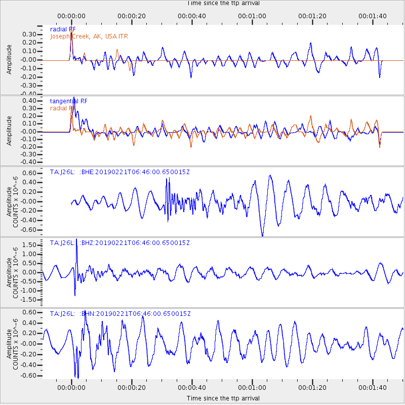
J26L Joseph Creek, AK, USA - Earthquake Result Viewer
*The percent match for this event was below the threshold and hence no stack was calculated.
| Earthquake location: |
Fiji Islands Region |
| Earthquake latitude/longitude: |
-20.9/-178.8 |
| Earthquake time(UTC): |
2019/02/21 (052) 06:34:39 GMT |
| Earthquake Depth: |
617 km |
| Earthquake Magnitude: |
5.6 Mww |
| Earthquake Catalog/Contributor: |
NEIC PDE/us |
|
| Network: |
TA USArray Transportable Network (new EarthScope stations) |
| Station: |
J26L Joseph Creek, AK, USA |
| Lat/Lon: |
64.50 N/143.56 W |
| Elevation: |
1144 m |
|
| Distance: |
89.3 deg |
| Az: |
14.473 deg |
| Baz: |
212.683 deg |
| Ray Param: |
$rayparam |
*The percent match for this event was below the threshold and hence was not used in the summary stack. |
|
| Radial Match: |
40.23756 % |
| Radial Bump: |
400 |
| Transverse Match: |
52.947186 % |
| Transverse Bump: |
400 |
| SOD ConfigId: |
13570011 |
| Insert Time: |
2019-05-02 13:38:51.300 +0000 |
| GWidth: |
2.5 |
| Max Bumps: |
400 |
| Tol: |
0.001 |
|
Signal To Noise
| Channel | StoN | STA | LTA |
| TA:J26L: :BHZ:20190221T06:46:00.650015Z | 3.1518807 | 5.328244E-7 | 1.6904967E-7 |
| TA:J26L: :BHN:20190221T06:46:00.650015Z | 2.0596995 | 3.3151582E-7 | 1.6095349E-7 |
| TA:J26L: :BHE:20190221T06:46:00.650015Z | 1.6301589 | 2.1274687E-7 | 1.3050683E-7 |
| Arrivals |
| Ps | |
| PpPs | |
| PsPs/PpSs | |


