You are here: Home > Network List > TA - USArray Transportable Network (new EarthScope stations) Stations List
> Station J20K Nowitna River, AK, USA > Earthquake Result Viewer
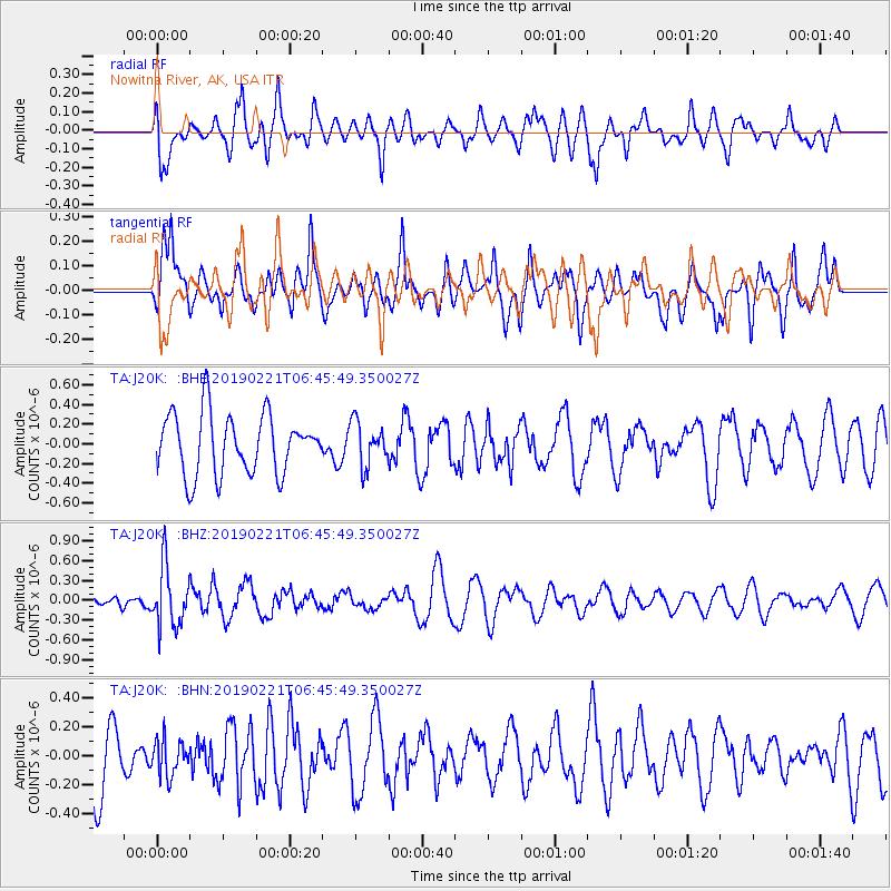
J20K Nowitna River, AK, USA - Earthquake Result Viewer
*The percent match for this event was below the threshold and hence no stack was calculated.
| Earthquake location: |
Fiji Islands Region |
| Earthquake latitude/longitude: |
-20.9/-178.8 |
| Earthquake time(UTC): |
2019/02/21 (052) 06:34:39 GMT |
| Earthquake Depth: |
617 km |
| Earthquake Magnitude: |
5.6 Mww |
| Earthquake Catalog/Contributor: |
NEIC PDE/us |
|
| Network: |
TA USArray Transportable Network (new EarthScope stations) |
| Station: |
J20K Nowitna River, AK, USA |
| Lat/Lon: |
64.18 N/154.15 W |
| Elevation: |
314 m |
|
| Distance: |
86.9 deg |
| Az: |
10.553 deg |
| Baz: |
203.022 deg |
| Ray Param: |
$rayparam |
*The percent match for this event was below the threshold and hence was not used in the summary stack. |
|
| Radial Match: |
69.03829 % |
| Radial Bump: |
400 |
| Transverse Match: |
55.168976 % |
| Transverse Bump: |
400 |
| SOD ConfigId: |
13570011 |
| Insert Time: |
2019-05-02 13:38:51.458 +0000 |
| GWidth: |
2.5 |
| Max Bumps: |
400 |
| Tol: |
0.001 |
|
Signal To Noise
| Channel | StoN | STA | LTA |
| TA:J20K: :BHZ:20190221T06:45:49.350027Z | 2.1108475 | 4.526136E-7 | 2.1442268E-7 |
| TA:J20K: :BHN:20190221T06:45:49.350027Z | 0.5088124 | 1.2242407E-7 | 2.4060748E-7 |
| TA:J20K: :BHE:20190221T06:45:49.350027Z | 0.72861034 | 2.2232251E-7 | 3.0513226E-7 |
| Arrivals |
| Ps | |
| PpPs | |
| PsPs/PpSs | |


