You are here: Home > Network List > TA - USArray Transportable Network (new EarthScope stations) Stations List
> Station 627A Terlingua Ranch, Terlingua, TX, USA > Earthquake Result Viewer
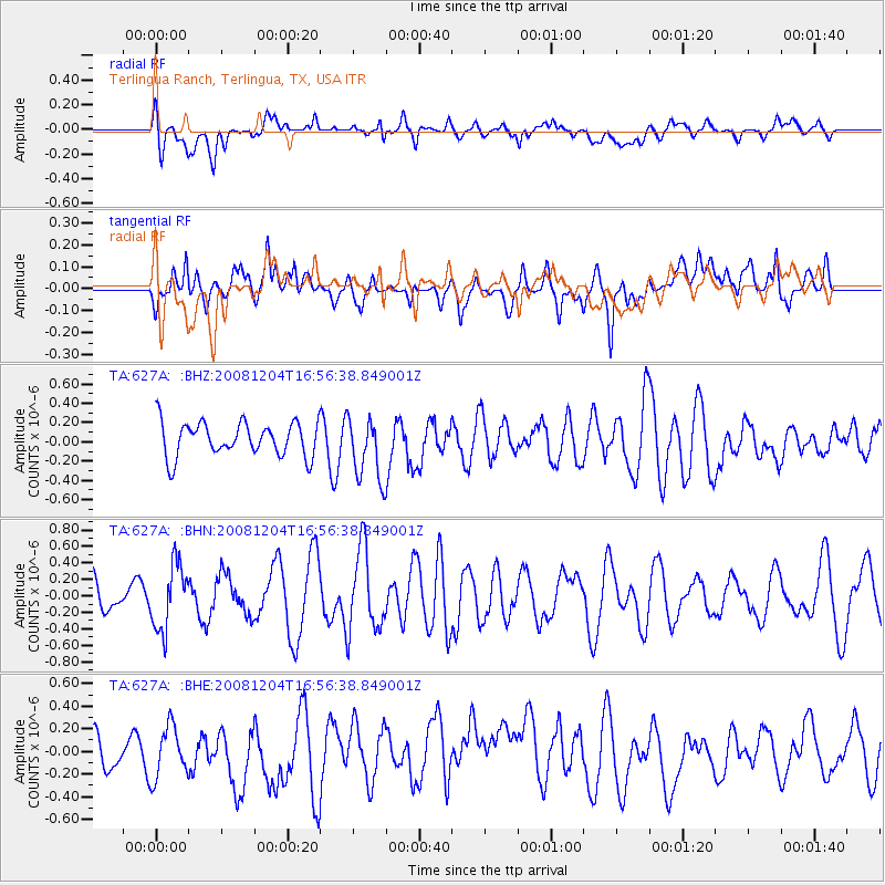
627A Terlingua Ranch, Terlingua, TX, USA - Earthquake Result Viewer
*The percent match for this event was below the threshold and hence no stack was calculated.
| Earthquake location: |
Chile-Bolivia Border Region |
| Earthquake latitude/longitude: |
-21.4/-68.3 |
| Earthquake time(UTC): |
2008/12/04 (339) 16:47:09 GMT |
| Earthquake Depth: |
115 km |
| Earthquake Magnitude: |
5.5 MB, 5.5 MW, 5.5 MW |
| Earthquake Catalog/Contributor: |
WHDF/NEIC |
|
| Network: |
TA USArray Transportable Network (new EarthScope stations) |
| Station: |
627A Terlingua Ranch, Terlingua, TX, USA |
| Lat/Lon: |
29.45 N/103.39 W |
| Elevation: |
1163 m |
|
| Distance: |
60.8 deg |
| Az: |
324.94 deg |
| Baz: |
142.135 deg |
| Ray Param: |
$rayparam |
*The percent match for this event was below the threshold and hence was not used in the summary stack. |
|
| Radial Match: |
64.18482 % |
| Radial Bump: |
400 |
| Transverse Match: |
71.27604 % |
| Transverse Bump: |
400 |
| SOD ConfigId: |
2658 |
| Insert Time: |
2010-03-06 20:15:50.091 +0000 |
| GWidth: |
2.5 |
| Max Bumps: |
400 |
| Tol: |
0.001 |
|
Signal To Noise
| Channel | StoN | STA | LTA |
| TA:627A: :BHN:20081204T16:56:38.849001Z | 1.4791608 | 3.9504505E-7 | 2.6707377E-7 |
| TA:627A: :BHE:20081204T16:56:38.849001Z | 1.5735376 | 2.2659648E-7 | 1.440045E-7 |
| TA:627A: :BHZ:20081204T16:56:38.849001Z | 1.8972571 | 3.3398226E-7 | 1.7603426E-7 |
| Arrivals |
| Ps | |
| PpPs | |
| PsPs/PpSs | |


