You are here: Home > Network List > TA - USArray Transportable Network (new EarthScope stations) Stations List
> Station R25A Fountain Ranch, Boone, CO, USA > Earthquake Result Viewer
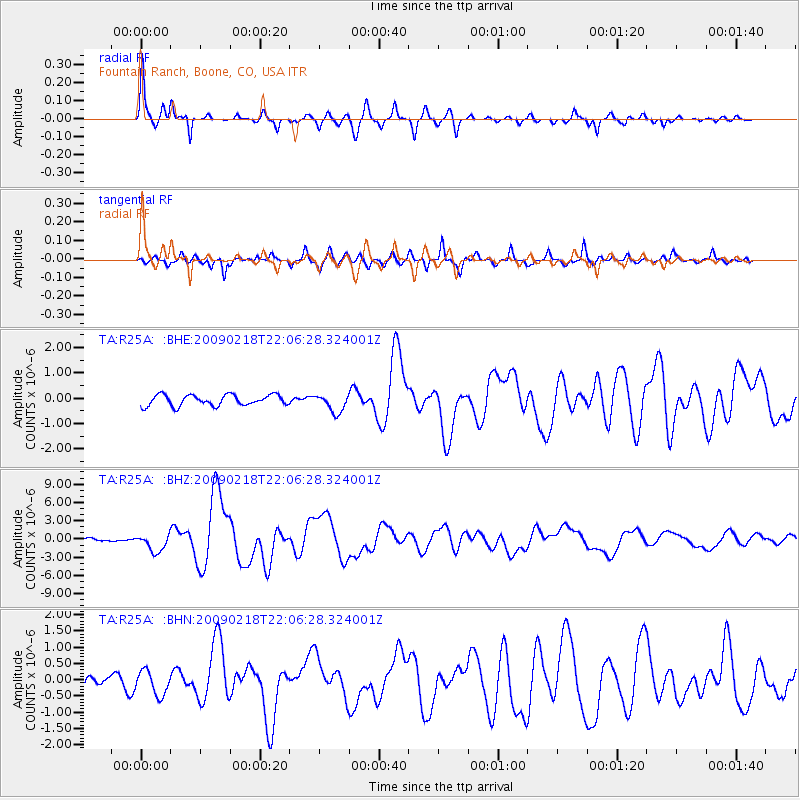
R25A Fountain Ranch, Boone, CO, USA - Earthquake Result Viewer

| Earthquake location: |
Kermadec Islands Region |
| Earthquake latitude/longitude: |
-27.4/-176.3 |
| Earthquake time(UTC): |
2009/02/18 (049) 21:53:45 GMT |
| Earthquake Depth: |
25 km |
| Earthquake Magnitude: |
6.8 MB, 7.2 MS, 6.9 MW, 6.9 MW |
| Earthquake Catalog/Contributor: |
WHDF/NEIC |
|
| Network: |
TA USArray Transportable Network (new EarthScope stations) |
| Station: |
R25A Fountain Ranch, Boone, CO, USA |
| Lat/Lon: |
38.15 N/104.28 W |
| Elevation: |
1461 m |
|
| Distance: |
93.8 deg |
| Az: |
48.735 deg |
| Baz: |
237.934 deg |
| Ray Param: |
0.041187804 |
| Estimated Moho Depth: |
49.25 km |
| Estimated Crust Vp/Vs: |
1.63 |
| Assumed Crust Vp: |
6.159 km/s |
| Estimated Crust Vs: |
3.767 km/s |
| Estimated Crust Poisson's Ratio: |
0.20 |
|
| Radial Match: |
95.15516 % |
| Radial Bump: |
259 |
| Transverse Match: |
86.48457 % |
| Transverse Bump: |
400 |
| SOD ConfigId: |
2658 |
| Insert Time: |
2010-03-06 20:17:15.440 +0000 |
| GWidth: |
2.5 |
| Max Bumps: |
400 |
| Tol: |
0.001 |
|
Signal To Noise
| Channel | StoN | STA | LTA |
| TA:R25A: :BHZ:20090218T22:06:28.324001Z | 6.386185 | 1.4328019E-6 | 2.2435958E-7 |
| TA:R25A: :BHN:20090218T22:06:28.324001Z | 1.6009876 | 3.8048455E-7 | 2.3765615E-7 |
| TA:R25A: :BHE:20090218T22:06:28.324001Z | 1.676192 | 3.5622452E-7 | 2.125201E-7 |
| Arrivals |
| Ps | 5.2 SECOND |
| PpPs | 21 SECOND |
| PsPs/PpSs | 26 SECOND |


