You are here: Home > Network List > TA - USArray Transportable Network (new EarthScope stations) Stations List
> Station R25A Fountain Ranch, Boone, CO, USA > Earthquake Result Viewer
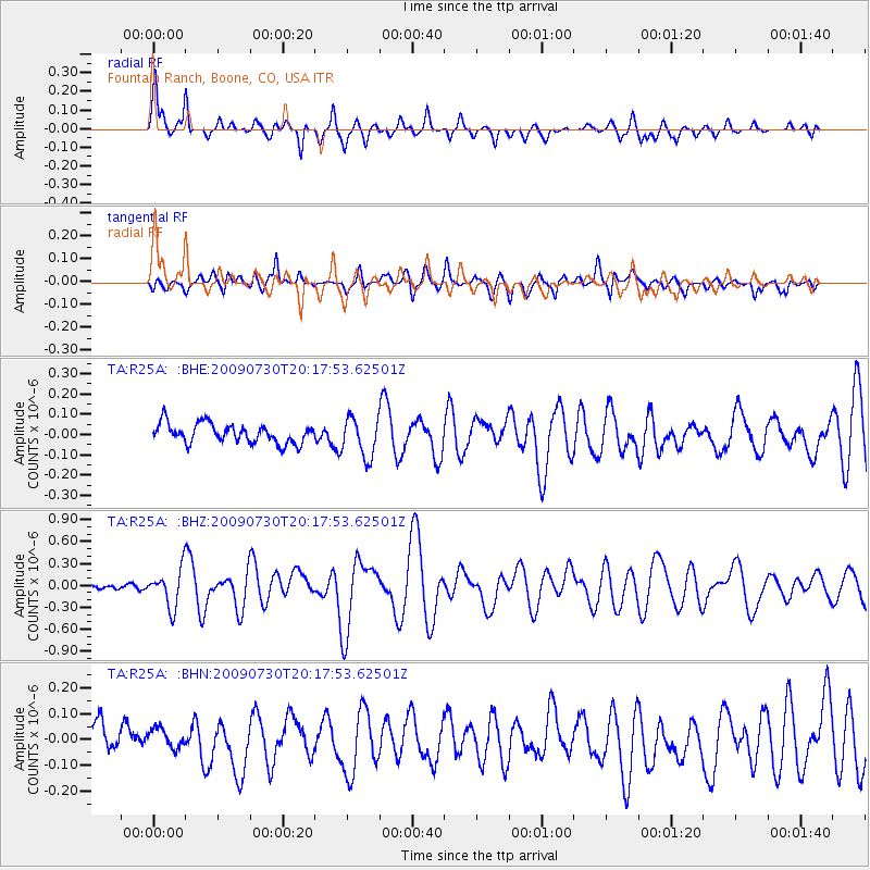
R25A Fountain Ranch, Boone, CO, USA - Earthquake Result Viewer

| Earthquake location: |
Tonga Islands |
| Earthquake latitude/longitude: |
-20.8/-174.3 |
| Earthquake time(UTC): |
2009/07/30 (211) 20:05:34 GMT |
| Earthquake Depth: |
10 km |
| Earthquake Magnitude: |
5.9 MB, 5.7 MS, 5.8 MW, 5.7 MW |
| Earthquake Catalog/Contributor: |
WHDF/NEIC |
|
| Network: |
TA USArray Transportable Network (new EarthScope stations) |
| Station: |
R25A Fountain Ranch, Boone, CO, USA |
| Lat/Lon: |
38.15 N/104.28 W |
| Elevation: |
1461 m |
|
| Distance: |
88.0 deg |
| Az: |
47.833 deg |
| Baz: |
241.556 deg |
| Ray Param: |
0.042914454 |
| Estimated Moho Depth: |
49.75 km |
| Estimated Crust Vp/Vs: |
1.62 |
| Assumed Crust Vp: |
6.159 km/s |
| Estimated Crust Vs: |
3.796 km/s |
| Estimated Crust Poisson's Ratio: |
0.19 |
|
| Radial Match: |
87.07652 % |
| Radial Bump: |
400 |
| Transverse Match: |
65.98788 % |
| Transverse Bump: |
400 |
| SOD ConfigId: |
2622 |
| Insert Time: |
2010-03-06 20:17:18.670 +0000 |
| GWidth: |
2.5 |
| Max Bumps: |
400 |
| Tol: |
0.001 |
|
Signal To Noise
| Channel | StoN | STA | LTA |
| TA:R25A: :BHZ:20090730T20:17:53.62501Z | 5.6080174 | 2.568527E-7 | 4.580098E-8 |
| TA:R25A: :BHN:20090730T20:17:53.62501Z | 0.6547692 | 3.9341536E-8 | 6.008459E-8 |
| TA:R25A: :BHE:20090730T20:17:53.62501Z | 2.0469074 | 9.7626845E-8 | 4.76948E-8 |
| Arrivals |
| Ps | 5.1 SECOND |
| PpPs | 21 SECOND |
| PsPs/PpSs | 26 SECOND |


