You are here: Home > Network List > TA - USArray Transportable Network (new EarthScope stations) Stations List
> Station R25A Fountain Ranch, Boone, CO, USA > Earthquake Result Viewer
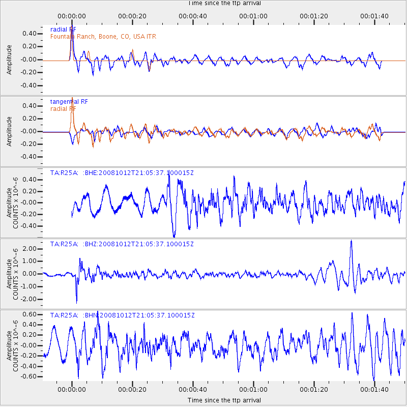
R25A Fountain Ranch, Boone, CO, USA - Earthquake Result Viewer
*The percent match for this event was below the threshold and hence no stack was calculated.
| Earthquake location: |
Southern Bolivia |
| Earthquake latitude/longitude: |
-20.1/-65.0 |
| Earthquake time(UTC): |
2008/10/12 (286) 20:55:41 GMT |
| Earthquake Depth: |
353 km |
| Earthquake Magnitude: |
6.0 MB, 6.2 MW, 6.2 MW |
| Earthquake Catalog/Contributor: |
WHDF/NEIC |
|
| Network: |
TA USArray Transportable Network (new EarthScope stations) |
| Station: |
R25A Fountain Ranch, Boone, CO, USA |
| Lat/Lon: |
38.15 N/104.28 W |
| Elevation: |
1461 m |
|
| Distance: |
68.7 deg |
| Az: |
327.585 deg |
| Baz: |
140.291 deg |
| Ray Param: |
$rayparam |
*The percent match for this event was below the threshold and hence was not used in the summary stack. |
|
| Radial Match: |
74.022675 % |
| Radial Bump: |
400 |
| Transverse Match: |
63.579964 % |
| Transverse Bump: |
400 |
| SOD ConfigId: |
2556 |
| Insert Time: |
2010-03-06 20:18:19.194 +0000 |
| GWidth: |
2.5 |
| Max Bumps: |
400 |
| Tol: |
0.001 |
|
Signal To Noise
| Channel | StoN | STA | LTA |
| TA:R25A: :BHZ:20081012T21:05:37.100015Z | 3.4549541 | 6.4014915E-7 | 1.852844E-7 |
| TA:R25A: :BHN:20081012T21:05:37.100015Z | 1.6481718 | 2.6958537E-7 | 1.6356631E-7 |
| TA:R25A: :BHE:20081012T21:05:37.100015Z | 2.085739 | 2.8583668E-7 | 1.3704336E-7 |
| Arrivals |
| Ps | |
| PpPs | |
| PsPs/PpSs | |


