You are here: Home > Network List > UW - Pacific Northwest Regional Seismic Network Stations List
> Station UMAT Pilot Rock, OR, USA > Earthquake Result Viewer
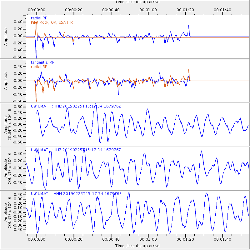
UMAT Pilot Rock, OR, USA - Earthquake Result Viewer
*The percent match for this event was below the threshold and hence no stack was calculated.
| Earthquake location: |
Central Mid-Atlantic Ridge |
| Earthquake latitude/longitude: |
4.3/-32.6 |
| Earthquake time(UTC): |
2019/02/25 (056) 15:05:33 GMT |
| Earthquake Depth: |
10 km |
| Earthquake Magnitude: |
5.5 Mww |
| Earthquake Catalog/Contributor: |
NEIC PDE/us |
|
| Network: |
UW Pacific Northwest Regional Seismic Network |
| Station: |
UMAT Pilot Rock, OR, USA |
| Lat/Lon: |
45.29 N/118.96 W |
| Elevation: |
1318 m |
|
| Distance: |
84.4 deg |
| Az: |
314.941 deg |
| Baz: |
89.573 deg |
| Ray Param: |
$rayparam |
*The percent match for this event was below the threshold and hence was not used in the summary stack. |
|
| Radial Match: |
59.234715 % |
| Radial Bump: |
400 |
| Transverse Match: |
64.15022 % |
| Transverse Bump: |
265 |
| SOD ConfigId: |
13570011 |
| Insert Time: |
2019-05-02 14:34:42.343 +0000 |
| GWidth: |
2.5 |
| Max Bumps: |
400 |
| Tol: |
0.001 |
|
Signal To Noise
| Channel | StoN | STA | LTA |
| UW:UMAT: :HHZ:20190225T15:17:34.167976Z | 1.012934 | 3.7941052E-7 | 3.745659E-7 |
| UW:UMAT: :HHN:20190225T15:17:34.167976Z | 1.0674394 | 2.661898E-7 | 2.4937228E-7 |
| UW:UMAT: :HHE:20190225T15:17:34.167976Z | 1.9864631 | 4.6455793E-7 | 2.3386184E-7 |
| Arrivals |
| Ps | |
| PpPs | |
| PsPs/PpSs | |


