You are here: Home > Network List > TA - USArray Transportable Network (new EarthScope stations) Stations List
> Station I30M Mount Dempster, Yukon, CAN > Earthquake Result Viewer
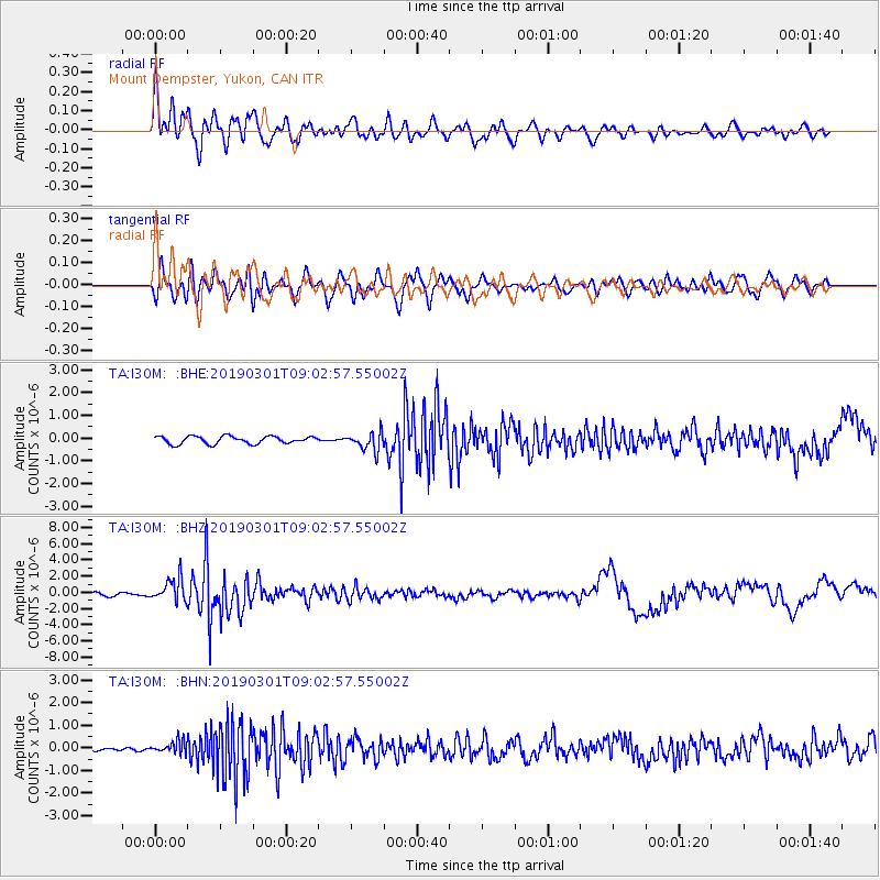
I30M Mount Dempster, Yukon, CAN - Earthquake Result Viewer
*The percent match for this event was below the threshold and hence no stack was calculated.
| Earthquake location: |
Central Peru |
| Earthquake latitude/longitude: |
-14.7/-70.1 |
| Earthquake time(UTC): |
2019/03/01 (060) 08:50:41 GMT |
| Earthquake Depth: |
257 km |
| Earthquake Magnitude: |
7.0 mww |
| Earthquake Catalog/Contributor: |
NEIC PDE/us |
|
| Network: |
TA USArray Transportable Network (new EarthScope stations) |
| Station: |
I30M Mount Dempster, Yukon, CAN |
| Lat/Lon: |
65.22 N/136.38 W |
| Elevation: |
1399 m |
|
| Distance: |
93.7 deg |
| Az: |
337.261 deg |
| Baz: |
117.424 deg |
| Ray Param: |
$rayparam |
*The percent match for this event was below the threshold and hence was not used in the summary stack. |
|
| Radial Match: |
78.51749 % |
| Radial Bump: |
400 |
| Transverse Match: |
75.39708 % |
| Transverse Bump: |
400 |
| SOD ConfigId: |
13570011 |
| Insert Time: |
2019-05-02 14:58:03.981 +0000 |
| GWidth: |
2.5 |
| Max Bumps: |
400 |
| Tol: |
0.001 |
|
Signal To Noise
| Channel | StoN | STA | LTA |
| TA:I30M: :BHZ:20190301T09:02:57.55002Z | 6.771557 | 1.4388866E-6 | 2.1248977E-7 |
| TA:I30M: :BHN:20190301T09:02:57.55002Z | 2.041167 | 2.7711295E-7 | 1.3576201E-7 |
| TA:I30M: :BHE:20190301T09:02:57.55002Z | 2.4000914 | 4.004673E-7 | 1.6685502E-7 |
| Arrivals |
| Ps | |
| PpPs | |
| PsPs/PpSs | |


