You are here: Home > Network List > TA - USArray Transportable Network (new EarthScope stations) Stations List
> Station J26L Joseph Creek, AK, USA > Earthquake Result Viewer
J26L Joseph Creek, AK, USA - Earthquake Result Viewer
*The percent match for this event was below the threshold and hence no stack was calculated.
| Earthquake location: |
Central Peru |
| Earthquake latitude/longitude: |
-14.7/-70.1 |
| Earthquake time(UTC): |
2019/03/01 (060) 08:50:41 GMT |
| Earthquake Depth: |
257 km |
| Earthquake Magnitude: |
7.0 mww |
| Earthquake Catalog/Contributor: |
NEIC PDE/us |
|
| Network: |
TA USArray Transportable Network (new EarthScope stations) |
| Station: |
J26L Joseph Creek, AK, USA |
| Lat/Lon: |
64.50 N/143.56 W |
| Elevation: |
1144 m |
|
| Distance: |
96.2 deg |
| Az: |
335.335 deg |
| Baz: |
111.089 deg |
| Ray Param: |
$rayparam |
*The percent match for this event was below the threshold and hence was not used in the summary stack. |
|
| Radial Match: |
67.22315 % |
| Radial Bump: |
400 |
| Transverse Match: |
50.89399 % |
| Transverse Bump: |
400 |
| SOD ConfigId: |
13570011 |
| Insert Time: |
2019-05-02 14:58:05.944 +0000 |
| GWidth: |
2.5 |
| Max Bumps: |
400 |
| Tol: |
0.001 |
|
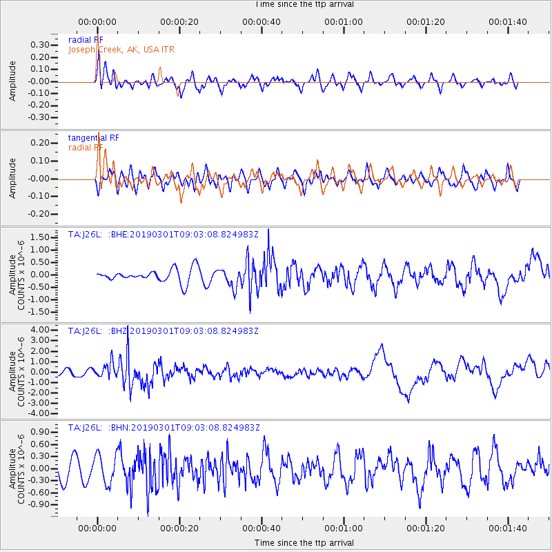
Signal To Noise
| Channel | StoN | STA | LTA |
| TA:J26L: :BHZ:20190301T09:03:08.824983Z | 2.9517877 | 7.180032E-7 | 2.432435E-7 |
| TA:J26L: :BHN:20190301T09:03:08.824983Z | 1.7975641 | 3.6810823E-7 | 2.0478168E-7 |
| TA:J26L: :BHE:20190301T09:03:08.824983Z | 1.4268664 | 3.801791E-7 | 2.6644338E-7 |
| Arrivals |
| Ps | |
| PpPs | |
| PsPs/PpSs | |


