You are here: Home > Network List > TA - USArray Transportable Network (new EarthScope stations) Stations List
> Station W23A Werner Place, Edgewood, NM, USA > Earthquake Result Viewer
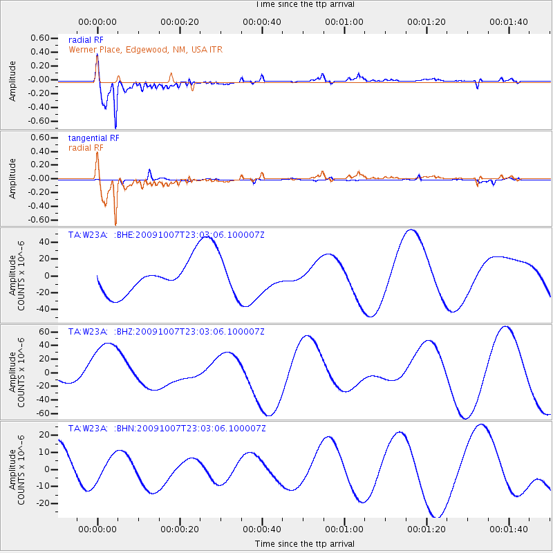
W23A Werner Place, Edgewood, NM, USA - Earthquake Result Viewer
*The percent match for this event was below the threshold and hence no stack was calculated.
| Earthquake location: |
Santa Cruz Islands |
| Earthquake latitude/longitude: |
-12.4/166.1 |
| Earthquake time(UTC): |
2009/10/07 (280) 22:50:15 GMT |
| Earthquake Depth: |
21 km |
| Earthquake Magnitude: |
5.8 MB |
| Earthquake Catalog/Contributor: |
WHDF/NEIC |
|
| Network: |
TA USArray Transportable Network (new EarthScope stations) |
| Station: |
W23A Werner Place, Edgewood, NM, USA |
| Lat/Lon: |
35.16 N/106.15 W |
| Elevation: |
2020 m |
|
| Distance: |
95.2 deg |
| Az: |
55.3 deg |
| Baz: |
258.618 deg |
| Ray Param: |
$rayparam |
*The percent match for this event was below the threshold and hence was not used in the summary stack. |
|
| Radial Match: |
91.77991 % |
| Radial Bump: |
400 |
| Transverse Match: |
28.454187 % |
| Transverse Bump: |
173 |
| SOD ConfigId: |
2622 |
| Insert Time: |
2010-03-06 20:26:13.135 +0000 |
| GWidth: |
2.5 |
| Max Bumps: |
400 |
| Tol: |
0.001 |
|
Signal To Noise
| Channel | StoN | STA | LTA |
| TA:W23A: :BHZ:20091007T23:03:06.100007Z | 1.6489254 | 4.6654513E-5 | 2.8293887E-5 |
| TA:W23A: :BHN:20091007T23:03:06.100007Z | 0.6493262 | 7.125883E-6 | 1.0974272E-5 |
| TA:W23A: :BHE:20091007T23:03:06.100007Z | 1.2603663 | 2.2274713E-5 | 1.7673205E-5 |
| Arrivals |
| Ps | |
| PpPs | |
| PsPs/PpSs | |


