You are here: Home > Network List > TA - USArray Transportable Network (new EarthScope stations) Stations List
> Station W23A Werner Place, Edgewood, NM, USA > Earthquake Result Viewer
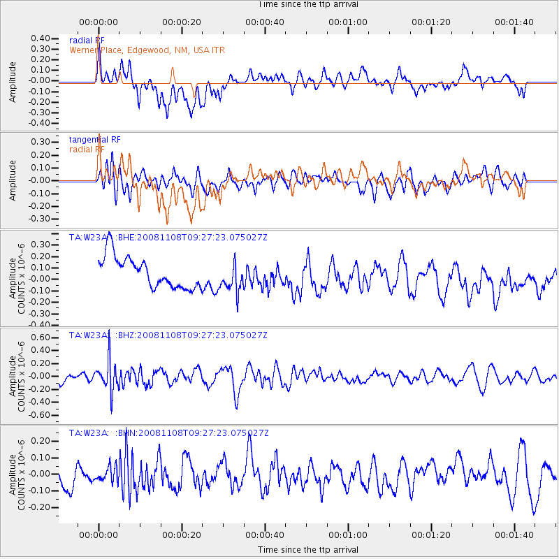
W23A Werner Place, Edgewood, NM, USA - Earthquake Result Viewer
*The percent match for this event was below the threshold and hence no stack was calculated.
| Earthquake location: |
Tonga Islands |
| Earthquake latitude/longitude: |
-15.2/-174.2 |
| Earthquake time(UTC): |
2008/11/08 (313) 09:15:51 GMT |
| Earthquake Depth: |
140 km |
| Earthquake Magnitude: |
5.5 MW, 5.3 MB |
| Earthquake Catalog/Contributor: |
WHDF/NEIC |
|
| Network: |
TA USArray Transportable Network (new EarthScope stations) |
| Station: |
W23A Werner Place, Edgewood, NM, USA |
| Lat/Lon: |
35.16 N/106.15 W |
| Elevation: |
2020 m |
|
| Distance: |
81.6 deg |
| Az: |
50.197 deg |
| Baz: |
244.845 deg |
| Ray Param: |
$rayparam |
*The percent match for this event was below the threshold and hence was not used in the summary stack. |
|
| Radial Match: |
44.61349 % |
| Radial Bump: |
400 |
| Transverse Match: |
48.580807 % |
| Transverse Bump: |
400 |
| SOD ConfigId: |
2658 |
| Insert Time: |
2010-03-06 20:26:48.249 +0000 |
| GWidth: |
2.5 |
| Max Bumps: |
400 |
| Tol: |
0.001 |
|
Signal To Noise
| Channel | StoN | STA | LTA |
| TA:W23A: :BHZ:20081108T09:27:23.075027Z | 3.5923078 | 2.3551569E-7 | 6.556111E-8 |
| TA:W23A: :BHN:20081108T09:27:23.075027Z | 0.64652807 | 4.427352E-8 | 6.847889E-8 |
| TA:W23A: :BHE:20081108T09:27:23.075027Z | 0.9593331 | 1.3039595E-7 | 1.3592354E-7 |
| Arrivals |
| Ps | |
| PpPs | |
| PsPs/PpSs | |


