You are here: Home > Network List > TA - USArray Transportable Network (new EarthScope stations) Stations List
> Station F21K Alatna River, AK, USA > Earthquake Result Viewer
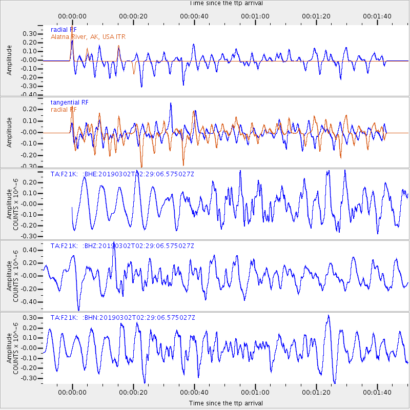
F21K Alatna River, AK, USA - Earthquake Result Viewer
*The percent match for this event was below the threshold and hence no stack was calculated.
| Earthquake location: |
Solomon Islands |
| Earthquake latitude/longitude: |
-7.0/155.8 |
| Earthquake time(UTC): |
2019/03/02 (061) 02:17:23 GMT |
| Earthquake Depth: |
69 km |
| Earthquake Magnitude: |
5.2 Mww |
| Earthquake Catalog/Contributor: |
NEIC PDE/us |
|
| Network: |
TA USArray Transportable Network (new EarthScope stations) |
| Station: |
F21K Alatna River, AK, USA |
| Lat/Lon: |
67.22 N/153.48 W |
| Elevation: |
597 m |
|
| Distance: |
82.3 deg |
| Az: |
17.713 deg |
| Baz: |
230.865 deg |
| Ray Param: |
$rayparam |
*The percent match for this event was below the threshold and hence was not used in the summary stack. |
|
| Radial Match: |
40.737198 % |
| Radial Bump: |
388 |
| Transverse Match: |
50.55957 % |
| Transverse Bump: |
400 |
| SOD ConfigId: |
13570011 |
| Insert Time: |
2019-05-02 15:05:06.976 +0000 |
| GWidth: |
2.5 |
| Max Bumps: |
400 |
| Tol: |
0.001 |
|
Signal To Noise
| Channel | StoN | STA | LTA |
| TA:F21K: :BHZ:20190302T02:29:06.575027Z | 2.1661398 | 2.6119423E-7 | 1.2058051E-7 |
| TA:F21K: :BHN:20190302T02:29:06.575027Z | 0.82598335 | 1.0589418E-7 | 1.2820377E-7 |
| TA:F21K: :BHE:20190302T02:29:06.575027Z | 0.68500537 | 1.04108516E-7 | 1.5198205E-7 |
| Arrivals |
| Ps | |
| PpPs | |
| PsPs/PpSs | |


