You are here: Home > Network List > IW - Intermountain West Stations List
> Station MOOW Moose Ponds, Wyoming, USA > Earthquake Result Viewer
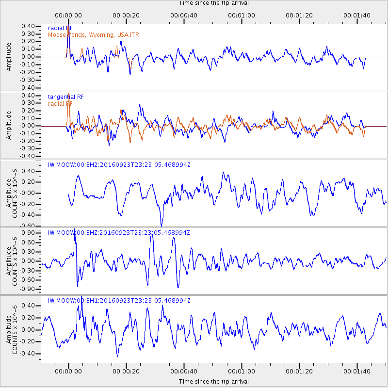
MOOW Moose Ponds, Wyoming, USA - Earthquake Result Viewer
*The percent match for this event was below the threshold and hence no stack was calculated.
| Earthquake location: |
Romania |
| Earthquake latitude/longitude: |
45.7/26.6 |
| Earthquake time(UTC): |
2016/09/23 (267) 23:11:20 GMT |
| Earthquake Depth: |
88 km |
| Earthquake Magnitude: |
5.6 MO |
| Earthquake Catalog/Contributor: |
NEIC PDE/NEIC ALERT |
|
| Network: |
IW Intermountain West |
| Station: |
MOOW Moose Ponds, Wyoming, USA |
| Lat/Lon: |
43.75 N/110.74 W |
| Elevation: |
2128 m |
|
| Distance: |
83.2 deg |
| Az: |
330.379 deg |
| Baz: |
28.54 deg |
| Ray Param: |
$rayparam |
*The percent match for this event was below the threshold and hence was not used in the summary stack. |
|
| Radial Match: |
69.93297 % |
| Radial Bump: |
400 |
| Transverse Match: |
54.98264 % |
| Transverse Bump: |
400 |
| SOD ConfigId: |
1634031 |
| Insert Time: |
2016-10-07 23:15:23.787 +0000 |
| GWidth: |
2.5 |
| Max Bumps: |
400 |
| Tol: |
0.001 |
|
Signal To Noise
| Channel | StoN | STA | LTA |
| IW:MOOW:00:BHZ:20160923T23:23:05.468994Z | 2.9428475 | 4.2944177E-7 | 1.459273E-7 |
| IW:MOOW:00:BH1:20160923T23:23:05.468994Z | 1.5313672 | 2.2028625E-7 | 1.438494E-7 |
| IW:MOOW:00:BH2:20160923T23:23:05.468994Z | 1.5777118 | 2.7271454E-7 | 1.7285447E-7 |
| Arrivals |
| Ps | |
| PpPs | |
| PsPs/PpSs | |


