You are here: Home > Network List > TA - USArray Transportable Network (new EarthScope stations) Stations List
> Station G12A Big Creek, Yellow Pine, ID, USA > Earthquake Result Viewer
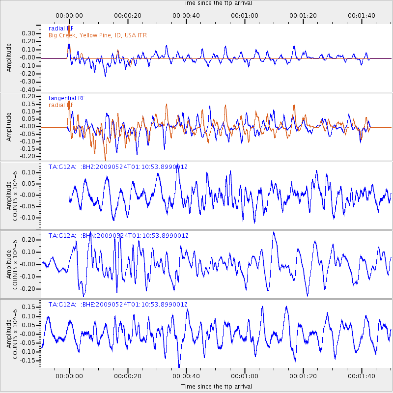
G12A Big Creek, Yellow Pine, ID, USA - Earthquake Result Viewer
*The percent match for this event was below the threshold and hence no stack was calculated.
| Earthquake location: |
Kermadec Islands Region |
| Earthquake latitude/longitude: |
-31.5/-177.7 |
| Earthquake time(UTC): |
2009/05/24 (144) 00:58:02 GMT |
| Earthquake Depth: |
4.0 km |
| Earthquake Magnitude: |
5.6 MB, 5.9 MS, 6.0 MW, 5.8 MW |
| Earthquake Catalog/Contributor: |
WHDF/NEIC |
|
| Network: |
TA USArray Transportable Network (new EarthScope stations) |
| Station: |
G12A Big Creek, Yellow Pine, ID, USA |
| Lat/Lon: |
45.13 N/115.33 W |
| Elevation: |
1780 m |
|
| Distance: |
95.0 deg |
| Az: |
39.009 deg |
| Baz: |
229.441 deg |
| Ray Param: |
$rayparam |
*The percent match for this event was below the threshold and hence was not used in the summary stack. |
|
| Radial Match: |
57.508766 % |
| Radial Bump: |
400 |
| Transverse Match: |
57.66994 % |
| Transverse Bump: |
400 |
| SOD ConfigId: |
2648 |
| Insert Time: |
2010-03-06 20:29:00.198 +0000 |
| GWidth: |
2.5 |
| Max Bumps: |
400 |
| Tol: |
0.001 |
|
Signal To Noise
| Channel | StoN | STA | LTA |
| TA:G12A: :BHN:20090524T01:10:53.899001Z | 2.832525 | 1.3199165E-7 | 4.6598583E-8 |
| TA:G12A: :BHE:20090524T01:10:53.899001Z | 1.0667803 | 5.264056E-8 | 4.9345267E-8 |
| TA:G12A: :BHZ:20090524T01:10:53.899001Z | 1.2557812 | 5.594471E-8 | 4.454973E-8 |
| Arrivals |
| Ps | |
| PpPs | |
| PsPs/PpSs | |


