You are here: Home > Network List > TA - USArray Transportable Network (new EarthScope stations) Stations List
> Station G12A Big Creek, Yellow Pine, ID, USA > Earthquake Result Viewer
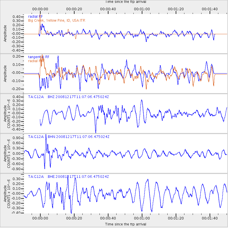
G12A Big Creek, Yellow Pine, ID, USA - Earthquake Result Viewer
*The percent match for this event was below the threshold and hence no stack was calculated.
| Earthquake location: |
Fiji Islands Region |
| Earthquake latitude/longitude: |
-17.7/-178.4 |
| Earthquake time(UTC): |
2008/12/17 (352) 10:55:59 GMT |
| Earthquake Depth: |
530 km |
| Earthquake Magnitude: |
5.8 MW, 5.2 MB, 5.8 MW |
| Earthquake Catalog/Contributor: |
WHDF/NEIC |
|
| Network: |
TA USArray Transportable Network (new EarthScope stations) |
| Station: |
G12A Big Creek, Yellow Pine, ID, USA |
| Lat/Lon: |
45.13 N/115.33 W |
| Elevation: |
1780 m |
|
| Distance: |
84.7 deg |
| Az: |
39.322 deg |
| Baz: |
238.55 deg |
| Ray Param: |
$rayparam |
*The percent match for this event was below the threshold and hence was not used in the summary stack. |
|
| Radial Match: |
61.465828 % |
| Radial Bump: |
400 |
| Transverse Match: |
68.53242 % |
| Transverse Bump: |
400 |
| SOD ConfigId: |
2658 |
| Insert Time: |
2010-03-06 20:29:20.022 +0000 |
| GWidth: |
2.5 |
| Max Bumps: |
400 |
| Tol: |
0.001 |
|
Signal To Noise
| Channel | StoN | STA | LTA |
| TA:G12A: :BHN:20081217T11:07:06.475024Z | 3.4933321 | 4.0793776E-7 | 1.16776114E-7 |
| TA:G12A: :BHE:20081217T11:07:06.475024Z | 1.7179645 | 1.6446197E-7 | 9.573071E-8 |
| TA:G12A: :BHZ:20081217T11:07:06.475024Z | 1.4528673 | 1.707947E-7 | 1.1755699E-7 |
| Arrivals |
| Ps | |
| PpPs | |
| PsPs/PpSs | |


