You are here: Home > Network List > TA - USArray Transportable Network (new EarthScope stations) Stations List
> Station G12A Big Creek, Yellow Pine, ID, USA > Earthquake Result Viewer
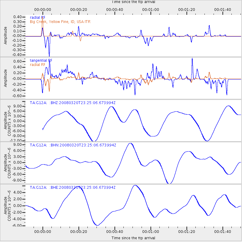
G12A Big Creek, Yellow Pine, ID, USA - Earthquake Result Viewer
*The percent match for this event was below the threshold and hence no stack was calculated.
| Earthquake location: |
Southern Xinjiang, China |
| Earthquake latitude/longitude: |
35.5/81.4 |
| Earthquake time(UTC): |
2008/03/20 (080) 23:12:00 GMT |
| Earthquake Depth: |
10 km |
| Earthquake Magnitude: |
5.6 MB |
| Earthquake Catalog/Contributor: |
WHDF/NEIC |
|
| Network: |
TA USArray Transportable Network (new EarthScope stations) |
| Station: |
G12A Big Creek, Yellow Pine, ID, USA |
| Lat/Lon: |
45.13 N/115.33 W |
| Elevation: |
1780 m |
|
| Distance: |
98.3 deg |
| Az: |
11.905 deg |
| Baz: |
346.247 deg |
| Ray Param: |
$rayparam |
*The percent match for this event was below the threshold and hence was not used in the summary stack. |
|
| Radial Match: |
61.86297 % |
| Radial Bump: |
400 |
| Transverse Match: |
70.1578 % |
| Transverse Bump: |
400 |
| SOD ConfigId: |
2504 |
| Insert Time: |
2010-03-06 20:29:35.244 +0000 |
| GWidth: |
2.5 |
| Max Bumps: |
400 |
| Tol: |
0.001 |
|
Signal To Noise
| Channel | StoN | STA | LTA |
| TA:G12A: :BHN:20080320T23:25:06.673994Z | 0.60947067 | 9.532887E-7 | 1.5641256E-6 |
| TA:G12A: :BHE:20080320T23:25:06.673994Z | 1.8107324 | 2.1027756E-6 | 1.1612847E-6 |
| TA:G12A: :BHZ:20080320T23:25:06.673994Z | 2.4779594 | 8.64012E-6 | 3.4867883E-6 |
| Arrivals |
| Ps | |
| PpPs | |
| PsPs/PpSs | |


