You are here: Home > Network List > TA - USArray Transportable Network (new EarthScope stations) Stations List
> Station G12A Big Creek, Yellow Pine, ID, USA > Earthquake Result Viewer
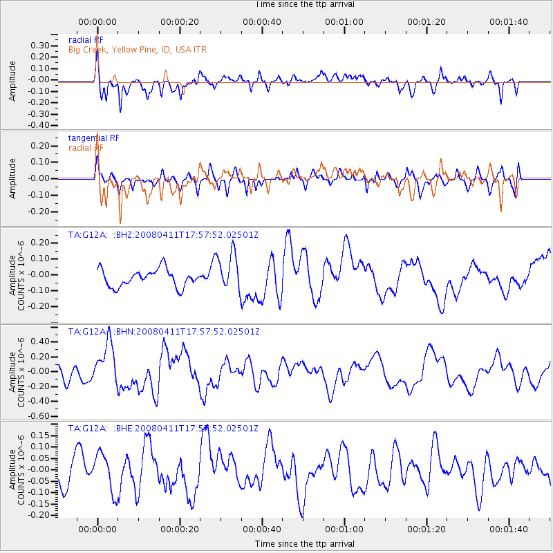
G12A Big Creek, Yellow Pine, ID, USA - Earthquake Result Viewer
*The percent match for this event was below the threshold and hence no stack was calculated.
| Earthquake location: |
Loyalty Islands |
| Earthquake latitude/longitude: |
-20.4/168.8 |
| Earthquake time(UTC): |
2008/04/11 (102) 17:45:05 GMT |
| Earthquake Depth: |
35 km |
| Earthquake Magnitude: |
5.7 MB, 5.9 MS, 6.0 MW, 6.0 MW |
| Earthquake Catalog/Contributor: |
WHDF/NEIC |
|
| Network: |
TA USArray Transportable Network (new EarthScope stations) |
| Station: |
G12A Big Creek, Yellow Pine, ID, USA |
| Lat/Lon: |
45.13 N/115.33 W |
| Elevation: |
1780 m |
|
| Distance: |
94.7 deg |
| Az: |
43.534 deg |
| Baz: |
245.881 deg |
| Ray Param: |
$rayparam |
*The percent match for this event was below the threshold and hence was not used in the summary stack. |
|
| Radial Match: |
62.324486 % |
| Radial Bump: |
400 |
| Transverse Match: |
58.44547 % |
| Transverse Bump: |
396 |
| SOD ConfigId: |
2504 |
| Insert Time: |
2010-03-06 20:29:47.082 +0000 |
| GWidth: |
2.5 |
| Max Bumps: |
400 |
| Tol: |
0.001 |
|
Signal To Noise
| Channel | StoN | STA | LTA |
| TA:G12A: :BHN:20080411T17:57:52.02501Z | 3.3670504 | 2.975941E-7 | 8.838422E-8 |
| TA:G12A: :BHE:20080411T17:57:52.02501Z | 2.0151212 | 8.783926E-8 | 4.3590063E-8 |
| TA:G12A: :BHZ:20080411T17:57:52.02501Z | 2.170542 | 1.1855396E-7 | 5.4619523E-8 |
| Arrivals |
| Ps | |
| PpPs | |
| PsPs/PpSs | |


