You are here: Home > Network List > TA - USArray Transportable Network (new EarthScope stations) Stations List
> Station G12A Big Creek, Yellow Pine, ID, USA > Earthquake Result Viewer
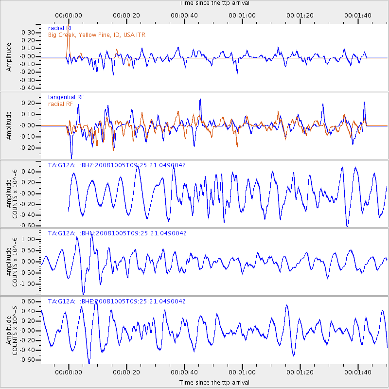
G12A Big Creek, Yellow Pine, ID, USA - Earthquake Result Viewer
*The percent match for this event was below the threshold and hence no stack was calculated.
| Earthquake location: |
Kermadec Islands, New Zealand |
| Earthquake latitude/longitude: |
-30.2/-177.2 |
| Earthquake time(UTC): |
2008/10/05 (279) 09:12:36 GMT |
| Earthquake Depth: |
10 km |
| Earthquake Magnitude: |
5.8 MB, 6.2 MS, 6.2 MW, 6.1 MW |
| Earthquake Catalog/Contributor: |
WHDF/NEIC |
|
| Network: |
TA USArray Transportable Network (new EarthScope stations) |
| Station: |
G12A Big Creek, Yellow Pine, ID, USA |
| Lat/Lon: |
45.13 N/115.33 W |
| Elevation: |
1780 m |
|
| Distance: |
93.7 deg |
| Az: |
38.715 deg |
| Baz: |
229.91 deg |
| Ray Param: |
$rayparam |
*The percent match for this event was below the threshold and hence was not used in the summary stack. |
|
| Radial Match: |
65.97061 % |
| Radial Bump: |
400 |
| Transverse Match: |
63.865433 % |
| Transverse Bump: |
400 |
| SOD ConfigId: |
2556 |
| Insert Time: |
2010-03-06 20:30:06.428 +0000 |
| GWidth: |
2.5 |
| Max Bumps: |
400 |
| Tol: |
0.001 |
|
Signal To Noise
| Channel | StoN | STA | LTA |
| TA:G12A: :BHN:20081005T09:25:21.049004Z | 3.0073009 | 6.4821916E-7 | 2.1554848E-7 |
| TA:G12A: :BHE:20081005T09:25:21.049004Z | 1.3468755 | 3.074753E-7 | 2.2828783E-7 |
| TA:G12A: :BHZ:20081005T09:25:21.049004Z | 1.0571538 | 2.5681763E-7 | 2.4293306E-7 |
| Arrivals |
| Ps | |
| PpPs | |
| PsPs/PpSs | |


